London Loop – Rickmansworth to Hatch End part deux

Rickmansworth duck pond

My last attempt at this stretch resulted in a failure when I failed to prepare for the biblical rain I encountered just a few miles in. I decided to start at Rickmansworth cutting out a mile of the route from where I finished off but there was a mike walk from Rickmansworth to join the LOOP. I got up early to a very frosty start, and headed to Wendover station to get the 08:23 train to Rickmansworth.

Although frosty the sun was low and the views from the train of the Chilterns was stunning at times. I need an app that would allow me to quick record locations with date and time as a list of places to return to and take a picture at some point in the future. I digress the point is that the weather was looking great for photo’s so I had my camera bag with me so I could carry DSLR and extra layers so I am prepared for all weathers.

Chiltern Trains are very posh I must say, I sat down and had to look around to check that I was not say in first class. At e table I was sat at there was two power outlets and as small sign indicating that WiFi was available. I connected up, the speed was not great but it was better than no internet at all. The table it self had pull it sections to allow passengers to get to their seats but then have room to get a kind of desk effect.

The Case is Altered pub

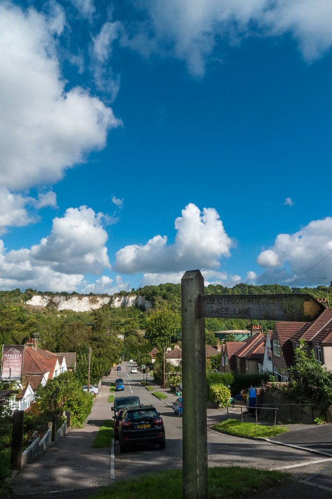
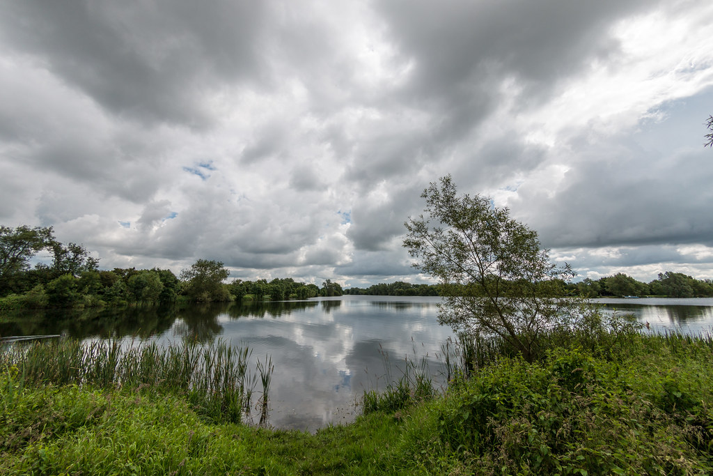
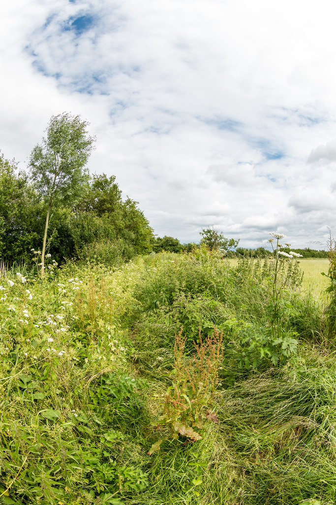
The start of the leg was quite urban, but I was loon in a country park with some lakes known as Batchworth lakes, I had also crossed the Grand union. I walked along a road and left the houses behind and eventually found a sign for the LOOP opposite a pub.

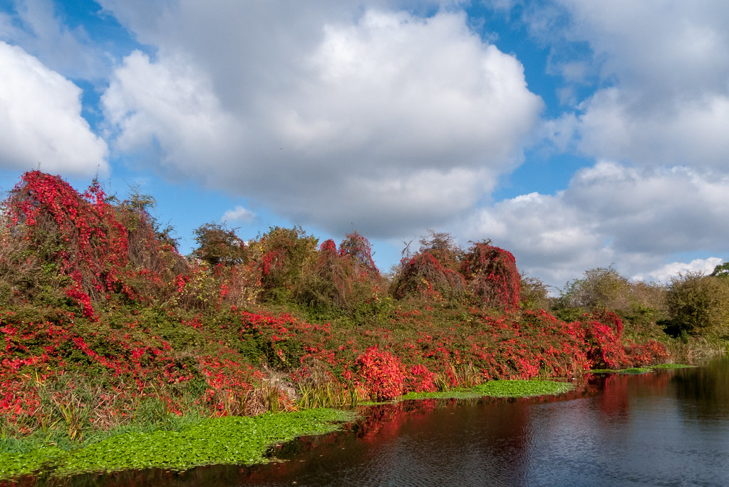
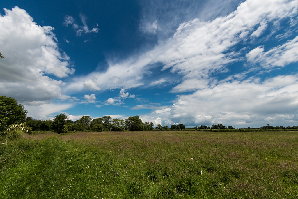
I missed a turn walking across Sandy Lodge Golf Club along the way but did not lose too much time, as the golfers were only too happy to point out that I was no longer on the designated footpath. I eventually came to a main road and a convenient petrol station had a Starbucks so I grabbed a coffee and a snickers then crossed the main road and walked until I found a convenient bench to have a rest and some sustenance. The wood were really showing their colours.

As I got towards Hatch End I caught up with a guy named Paul who was also doing the loop. We got chatting for half a mile or so and we swapped notes about the LOPP and other walks. He had done the London Ring which I may make my next walk. He wa retired and was able to walk during the week too. He said that he sometimes joined walkers clubs on their trips out to the Chilterns from London. I might give that a go one day, but I do enjoy the me time I get ding these walks.

Tube carriage

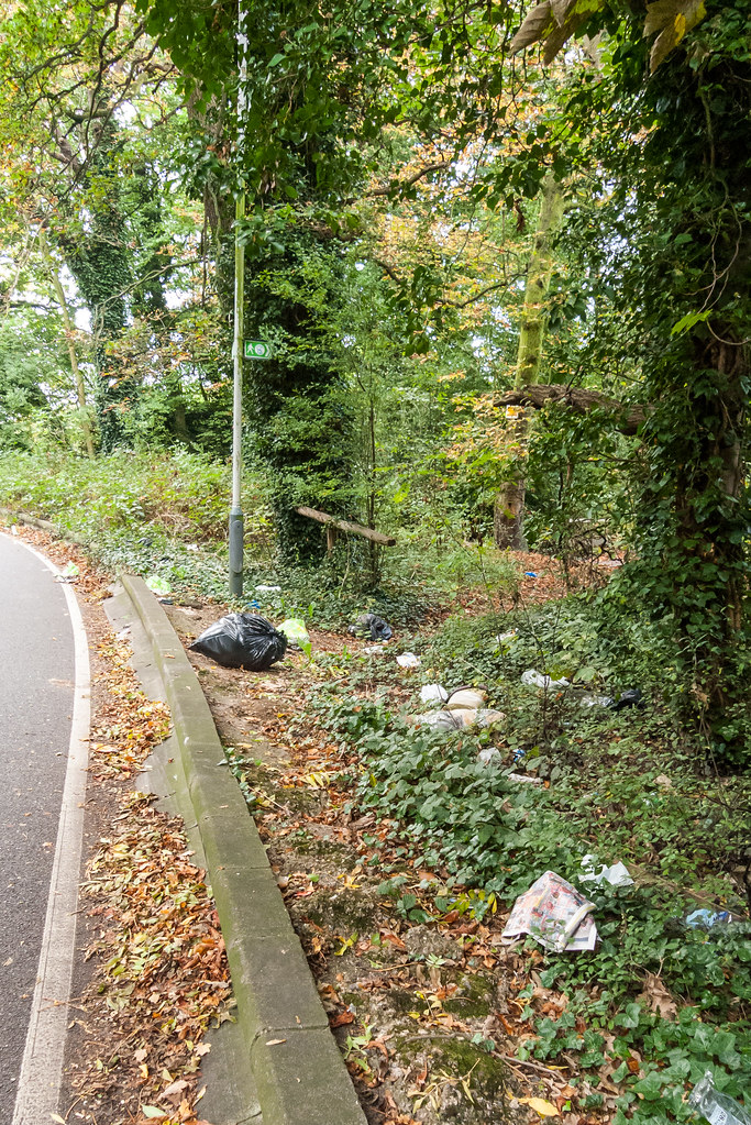
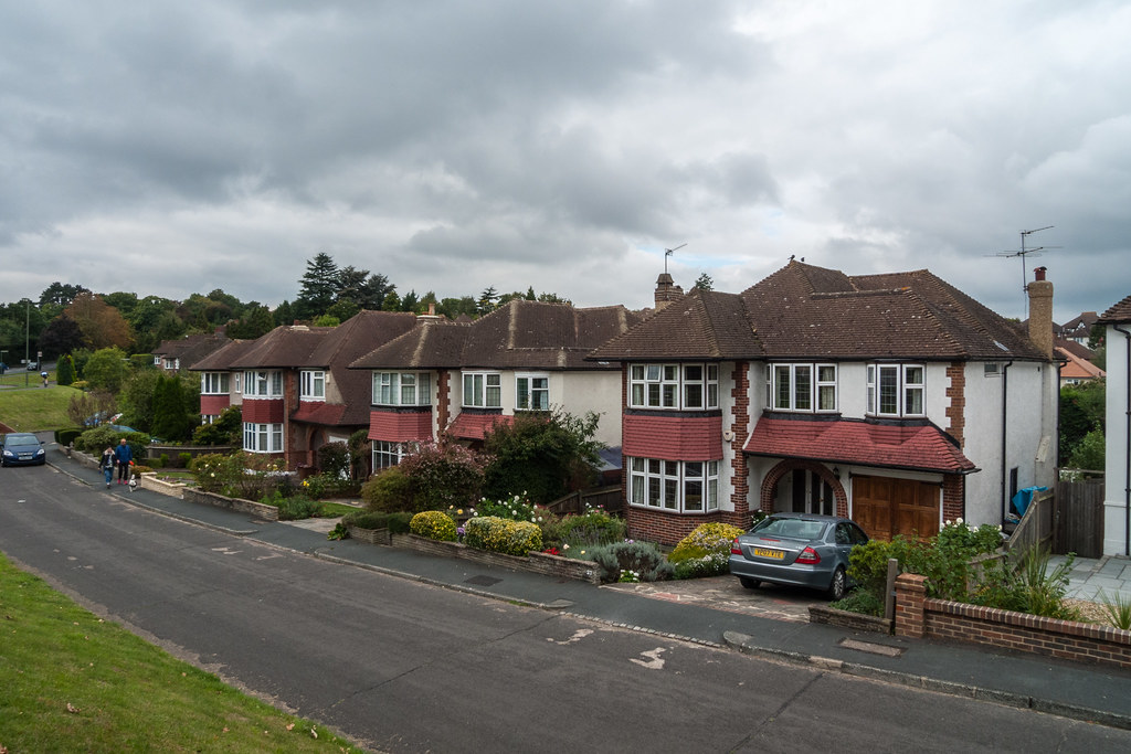
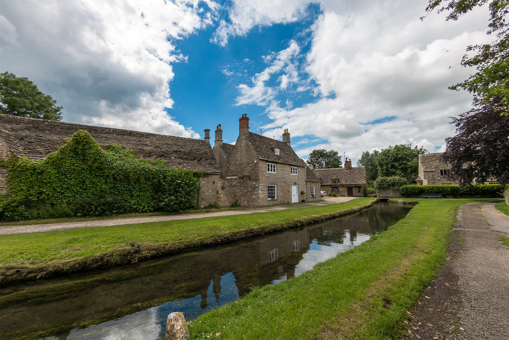
After crossing another main road I came across a load of fly tipping, it is something that is really unnecessary. Through Grins Dyke golf club not clear signing toward the end but again some golfers pointed me in the right direction. Stanmore is quite a posh neighbourhood with substantial houses.

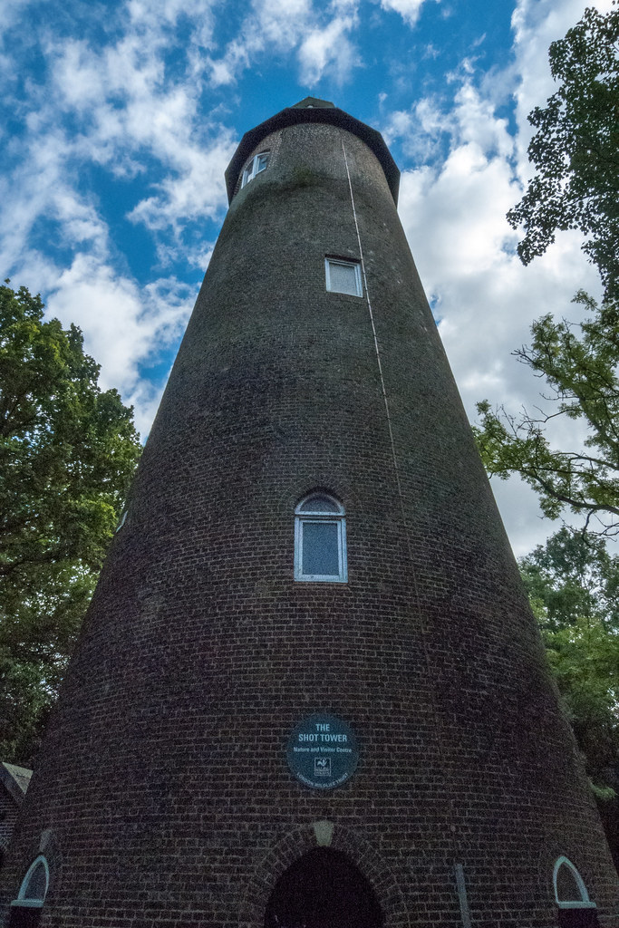
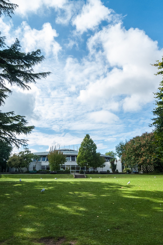
I walked through Bentley Priory which according to their website is “where the Battle of Britain was won” there is a museum and stuff about that. I made a mental note to put it on the list of places to visit. I stopped for a rest in the adjacent nature reserve and fond out that the batteries on my phone were dead. I also found out that the cable for my power bank battery was also no good. Luckily  I had looked at the map a few moments before and had memorised where I needed to go, and I eventually found a bus stop to get me to Stanmore station.

From Stanmore I gfot the tube to Wembley Park then changed and did almost a U turn to get to Harrow on the Hill. As I exited I was asked to do a survey about my journey and I consented! I then had a bout 20 minutes to get the train back to Wendover, so I checked out the shopping centre and managed to haggle for a cable to charge my phone. I grabbed  a bottle of wine from the Tesco express then a coffee in the Station and then only had a 2 minute wait for the train.

I was back reasonably early 15:30 and was quite tired. That evening we went to a Music Quiz organised by the local church and manged to win.

London Loop – Uxbridge to Hatch End failed

I had some holidays to use up, and already had the Monday off for our annual pilgrimage to Brighton for the Veteran Car run si u tagged a say either side to make a long weekend. The plan was Uxbridge to Hatch End about 13 miles so on the long side, but it’s in North London so very accessible for me.

I was up eatlyish and headed by car to Hatch End station where to my surprise the small car park had plenty of spaces, the fee was £4.50 for the day. It turns  out a bus to Rayner’s lane was the best but it is always good to leave the car at a transport hub if there is a need to bail out. There was talk of rain, so it was a distinct possibility, and it had rained all the way to the station.

I got the H12 bus opposite the station, it made slow progress as the traffic was heavy compared weekends, and just after rush hour to boot.

I was distracted by this post when I looked up and saw we had stopped at Rayner’s lane but is was too late to get off the bus so I alighted at the next step. It turned out the sign had said towards Rayner’s Lane si I had to wait for another bus before eventually alighting at my intended destination.

Rayner’s Lane has an interesting selection of shops, some clearly long established businesses, other more recent a few Asian supermarkets a couple of Polish grocers. I found the art deco tube station at the top of the high street, and waited for the Metropolitan train to Uxbridge.

I got on the bus to Rayners lane but got off at the wrong stop so had to wait again for the next bus, interstingly Oyster only charges me for a single journey. Rayner’s lane shops is interesting traditonal shops along side shops clearly opend by immigrants, it would be a great place to do your weekly shopping. Next leg would be on the underground.

I eventually reached Uxbridge at 11:05 and headed straight to the shopping centre for a pee, then headed out to find the canal tow path I had used the week before. After a while it started to rain. The path follows the canal and us pretty uninspiring especially in the rain. Eventually I shelteres under a bridge, and on consulting the map noticed it was about 1km to pub, so I pushed on.

The Bear on the Barge cheese sandwich and refuge from the rain that had become quite heavy. Tempted to grab one of the umbrella in the coat stand that appear to have no owner. The song “These boots are made walkin” which seemed to be nagging me to get back on the LOOP path.

I did a few more miles but the rain for harder. Sheltering under a canal bridge near Hatfield Hospital I decided that it was not fun any more and th e rain was showing no signs of stopping, so decided to bail out. It was however about a mike to the nearest bus stop and with no trees to lessen the rain. I had a 10 minute wait.

The journey back involved two bus journeys and a tube. First a bus to Northwood station, followed by tube to Pinner and finally a bus to Hatch End

London Loop – Hatton Cross to Uxbridge

London loop rubbish

I woke up to a fight morning, but the weather people were promising sunny weather, so I would keep the momentum going, Hatton Cross to Uxbridge which is 11 miles. By the time I had parked up in Uxbridge the air was still chilly but blue sky was starting to be visible through the now low clouds.

I missed a 222 but they run every 7 minutes so it was not long before another one came along. I decided to shave 10 minutes off the loop by skipping half a mile of the loop to save having to change busses. When I got off the bus I must have got my map up the wrong way because I crossed the road and walked to where it crosses the LOOP. At the zebra crossing I noticed a lady and two boys, she was carrying the same print out I had in my back pocket for the sections I was doing that day, I wished them luck with it but i’m not sure they made the connection. They were however the first people I had seen who were without doubt doing the loop (or part of), other people I have seen may have been but without asking I will never know.

Tesla cockpit

Once on the path I crossed a park then I had to cross a road at the end of a housing estate, the rubbish at the side on the bend in the road was awful the worst I had seen so far on the walk, it was on Cranford lane. I followed the river for a mile or two and came across a church which was almost smothered by the M40 which I passed under and about 500 metres further on the path turned left at 90 degrees and follows the Grand Union Canal for a couple of miles as it edges through the industrial area of Hayes.

I left the canal and the path took me through a business park then across the edge of Stockley Park golf club across a dual carriage way and across Stockley park itself. Eventually dropping me out on a business park on the edge of Yiewsley. I decided a coffee was in order so my eyes were on alert. I spotted a Tesla showroom and ditched the coffee idea for a look at the cars inside.

Tesla can in the show room

The sales man was a friendly chap even when I explained that I was far from being a customer. He answered all my questions and we chatted about how Elon Musk was really just a battery manufacturer. he invited me to have a sit in the cars and encouraged me to play with the massive touch screen that they have in the centre console. Finally he offered to get me a coffee from the fancy machine they had, thus saving me a couple of quid. I thanked him and set off again and was soon dumped back on the canal towpath, where I spotted my second lift boot converted to a canal boat with living accommodation, I had previously seen one on the Thames river bank.

Red autumn leaves and green pond weed

I was feeling a bit peckish so when I passed a large Tesco on the side of the canal I popped in and got a sandwich and a bottle of water, then where the path takes a left at Packet Boat Marina near Little Britain I stopped at a handy bench and consumed them. Soon after the path leaves the canal and head north following the Colne river leaving the Slough arm of the Grand Union to go West. I carried on the Grand Union for a while before realising I had missed the turn, however I was able to se two instances where the canal was bridged over a couple of rivers.

The Colne river passes through an area with lakes and I saw plenty of wild life and not many people. I saw both a Heron and Little Egret both in a tree which is not usual to see before roosting time in the evening. The path follows the river round the industrial estate on the west side of Uxbridge and ten joins the Grand Union again for the last couple of miles. I did not take the first opportunity to get back to the car but took the next left so that I reduced the length of the next section to Moor Park. It looks like it will be mainly on the Grand Union.

London Loop – Kingston Upon Thames to Hatton Cross

Deer rut in Bushey Park

This section was going to be a strange one, from Kingston ending up at Hatton Cross tube station, and thankfully a shortish one, 8.5 miles, after the previous days 15 miler. It would be the first time I would not use my Railcard as I would be using the car and a bus.  I would be doing an official section so it was well documented.

I set off at a reasonable the and set the satnav for the NCP car park at the Hatton Cross station. It took me round the M25 and M4 things went a bit wrong after that.  The satnav said I had arrived but it was nowhere to be seen, I carried on a bit but then had to stop to consult Google maps, which soon got me to outside the station but the on a road with no access to the far park, it was on the A30, so I had to go 1 mile back and forth to get to the entrance.

The Shot Tower Crane Valley

Luckily the bus was due and I was soon en route to Kingston, as we got closer things became familiar as places I had passed when doing the Thames Path. The bus stop was near the bridge on the side I had finished but it did mean I would miss a few hundred yards of  the Loop. Once across the river I entered Bushey park which was very popular, with loads of people about. I could not resist a stop at the woodland garden coffee establishment for a coffee and a piece of cake, I had to take the day easy, after all, because of my sore foot.

The deer in the park were in full rut and far more approachable than the ones in Ashridge. There were plenty of photographers and long lenses about. The path keeps mainly to the wooded and lakes areas. It was a real pleasure to walk through, alas it came to an end and the path spent a while on roads and in housing estate until it enters Crane Park, and follows the river Crane for a mile and a bit.

BA Hangar heathrow

Halfway through the park there is a shot tower which has been renovated and is now a visitor centre for the London Wildlife Trust, unfortunately it was closed, I bet the view is good from the top. According to the web “Once the site of the Hounslow Gunpowder Mills, Crane Park Island is a beautiful reserve where you could be lucky enough to spot a majestic kingfisher or the threatened water vole.

It is a mosaic of woodland, scrub and reedbed, which due to careful management provides a home for the increasingly scarce water vole.

The island welcomes visitors throughout the year and has good facilities for people with disabilities. School children on specially organised visits can investigate the rich aquatic life in the shallow stretches of the Crane.

NCP car pak under the flight path at Hatton Cross

The old Shot Tower was opened as a visitor centre in 2004. It is open to the public every Sunday afternoon between 1.30pm and 4.30pm and for special events. Call 07702 669 888 for details. It was 13:20 so I hung around for 10 minutes, until a lady on a bicycle turned up and opned up shop. I asked if it was worth climbing the stairs to the top, and convinced me it was. Given I had walked quite a way by then ot was quite some effort and a bit of a disappoint men as the view was not quite over the tree tops.

Next came Hounslow Heath which is a large expanse of heath land and I spotted quite a lot of birds about. It is directly under the Heathrow flight path so it can be a bit noisy. I got my scanner out and listened to the air traffic controllers and ground staff going about their jobs. I passed through a wood called Donkey Wood and joined a river for the rest of the walk, it was pretty uninspiring as it looked polluted and ran down the back of houses and industrial buildings. I hit a dual carraige way and had to walk about 1km along the pavement to get to Hatton Cross station before I could tick that sections off.

London Loop – South Coulsdon to Kingston upon Thames

Sir Francis Crick Institute

A bit of a milestone thus section as I was about to hit the Thames again, so that is kind of halfway. It was a going to be a tough one because the distance is more than 12 miles, but I figured if I start out early I would have plenty of scope for rests. I was up at 7 and resisted the urge to switch my PC on and be distracted by the internet, I was aiming for the 08:11 but when I got to the station I was in good time for the 08:01, which was slower but got to Euston 4 minutes earlier.

I expected to use the Victoria line but Google maps suggested an alternative, using the Thames link from St Pancras, which meant a 5 minute walk. It gave me an opportunity for another London terminus tick and a chance to see  the Sir Francis Crick Institute building. I noted that the cafeteria had a few two people tables but mainly a few long tables with chairs down each side. I guess that it means that people will mix more because they end up sitting next to people. In my work cafeteria all the tables are round and you end up with the same people on the tables each day. With a long table you still get the groups but they are sat next to other groups rather than being isolated. I quickly took some pano shots as the building is tall and hard to get into one shot.

Suburbia seen from the London Loop path

At the St Pancras I quickly found the right platform and my timing was perfect, the train pulled away about 30 seconds after I boarded. The Thames link crosses the river close to Tate Modern in fact the station is over the river and you get a great view of the gallery, The Shard and The City buildings named after thing you find normally in a kitchen. The train went as slow as it did last week and after crossing the Thames soon joined the same set of rails. I theorised that it always went slow but would speed up when it got away from all the junctions and was speeding through the countryside to Brighton.

The route out of Coulsdon was quite well signposted and although it starts off in the town soon you are in the countryside. At the edge of Coulsdon I came across a funeral directors called  W A Truelove & Son Ltd which I thought was an interesting name. Close the Oak Park I cheated a bit, missing off a dog leg to avoid a couple of hundred yards of road, and I thought I had missed the Mayfield lavender. I had but not only was the place closed but the lavender was obviously in hibernation with hardly a purple shade evident in the field. There was however a red phone box and a wooden gazebo, which I guess photographers use as props. The path I took did run along one edge of the field.

Spaceship building

I rejoined the path at a road crossing and entered Oak Park, it started to rain so I took the opportunity for a rest and a coffee in the café, in the hope that the rain would stop when I ventured outside again. The BBC had promised rain but when I checked the latest predictions it was more optimistic. I had to cross a Golf course with dual carriageway between first and second 9 which must be a pain for the players. The LOOP is not well sign posted across the course, and I clearly looked lost too, as a cuple of golfers asked me if I was, not that they could tell me where the path was!

Banstead Down is an SSSI and I saw my third Jay of the day, the first one in a front garden. I also noticed holes with acorns in the bottom evidence of squirrels and jays preparing for winter. The Golf course dumped me into a housing estate, which looked quite posh. Then I noticed that I was in the borough of Epsom and Ewell, and a sign informed me that it was twinned with Chantilly France.

Across Warren Farm Woodland Trust I had to keep to the paths as there were of dog walkers and shit when you are off the paths. I got to Ewell Castle School.ans then into the centre of the town it was lunchtime and the first good establishment I came across was an Italian, it was empty which was a bit worrying, but it looked good and they has spaghetti di mare on the menu. I needn’t have worried as no sooner as I has orders more customers started to arrive. They served bread in a basket which was a nice touch, I ordered a Perrier to go with my lunch which turned out to be a 75cl, I was not carrying water so managed to drink it all. The spaghetti was excellent, and I lingered a while to finish off he water and avoid a stitch when I did get back on the Loop. As I left the restaurant the sun was shinning.

Berrylands interesting building

I walked though Bourne Hall which now has an interesting spaceship of a building housing a museum of local history. A sign told me I had 7 and a quarter miles to Kingston. I passed East Ewell station and realised I was off the path so I ended up taking a longer route and missing a kilometre of the path, but I was soon back in n the Loop path.

Next up was Hogsmill NR and Jays number 5 and 6. The path follows the very long reserve for quite a few miles. At one point the path went along a road rather than keeping to the rivers edge, seemed like a pointless detour so I kept to the river. Before the detour I stopped at a Toby Inn for a lemonade and to rest my feet.

Crossed dual carriageway with a double back to use a subway, then into Elm Wood meadows. The path continues to follow the river Hogsmill until you finally hit a housings estate then you go under a railway, but not before spotting 9 Parakeets in a flock. I passed Hogsmill sewage treatment which smells of piss, so I did not hang around. Next up was Surbiton cemetery and some near by stone masons. The outskirts of Kingston came swiftly after and my feet had had enough, 15 miles seems to be my upper limit. I weaved my way up Kingston high street dodging the shoppers, and found the station. I has a painful run to get to platform 3 for the 16:18 to Waterloo, it saves me waiting 15 minutes for the next train.

I got off at Vauxhall and got the Victoria line to Euston then made the mistake of thinking I could get a bottle of water from M&S (no queue at the checkout) and get to platform 8, I missed the train by seconds, so had to get one 20 minutes later. As it happens the second one almost caught up with the first one, so little re was lost. All in all a good day where I managed 15 miles, which although probably a bit too far is good to know I can.


London Loop – Croydon to Coulsdon

London loop view near Croydon

Holidays and other stuff had got in the way of London Loop sections, although it was a Sunday the weather looked good so I got up early and headed to Berkhamsted, to do the section from Croydon to Coulsdon.

On Saturday I did a trip to Banbury to have a look at the North Signal box, which was to be demolished on Monday. I invited my dad and Helen’s dad and they both enjoyed the opportunity, to have a go at pulling the leavers, something they had never got to do whilst young train spotters.

Strange pond with daisy circle

It was cold and overcast when I got to the station, but on the journey to Euston on the 08:40 the clouds started to clear. The Victoria line took me to Victoria station where I had time to get a coffee before the slightly delayed 08:32 to Brighton could take me to East Croydon. I’m not sure if it was because the train was delayed or not but they announced that it was not stopping at some of the scheduled stations, and then proceeded to stop many times between stations. Eventually slightly later than advertised the train got to East Croydon and I alighted.

It took a while to find the tram stop as I had exited from the station via a side entrance and the tram stops are at the main one. The trams have quite an acceleration on them and quickly get up to speed, there should be more adoption of them in my opinion. I got off at the Combe Lane stop and quickly found the LOOP path.

The path is again surprisingly rural sticking to woods, meadows and down land, I eventually got to Selsdon where a parade of shops was a great place to get some lunch, as I was travelling light with no camera bag. I grabbed an egg sandwich Snickers, and a bottle of water at the  cooperative, crossing back over the road I noticed a .non-branded fried chicken takeaway, and so I popped in GR some chips to go with my lunch. The menu pictures showed MacDonald style chips so I ordered a large portion. When the portion was handed over it was a large box full of chips the type of they use to hold the chicken meals they sold. I tried my best but could not finish them, and I had to save my egg sandwich for later. I later lost the Snickers from a hole in the carrier bag I was using.

The path was really against the grain of the landscape constantly crossing hills and valleys rather than running along the valleys. It was as if I was in the Chilterns with chalk downs and clifss evident. A very just be landscape looking really great in the autumn sun.

Mini observatory on the London Loop

I passed through quite a few City of London Corporation park lands, and a could of National Trust parcels of land. Henley comments n also has an airfield in the middle of of it but there was no vantage point from the path nor any evidence of activity. It was however still owned by the ministry of defence.

The final mikes after Coulsdon Common involved walking through or past some strange names such as Happy Valley, Devilsden woods and For thing Downs which was about mile and a half of hill with great views all around. Just before Happy Valley I came across a couple with several dogs including two Labradors one of the came bounding towards me followed bt the second one which was a bit bigger, and proceeded to body slam me against the inside of my right knee, almost taking me out out in the process. I was lost for words at the time, the bloke looked concerned but the woman just said “Labradors are boisterous aren’t they?”, I just carried on walking with a bit of a limp. Had I been a smaller person or someone who was frail they definitely would have floored the person. The last mile was down hill and got me to Coulsdon South rail station, where I had a half hour wait for a train to London Bridge, which stopped first at East Croydon.

I has a rush from the mainline station, with only minutes to spare to get to the underground then to the right platform at Euston for the fast train to Berkhamsted. I had time to grab the Snickers I owed myself and a bottle of water before running to the platform to get on the train. There were not many spare seats but I managed to find a single spare seat.

All in all a a good day out with lovely landscapes and beautiful skies. Quite a long walk at over 12 miles for the day.


London Loop – Orpington to Croydon

Saint Giles the Abbot Church Farnborough

My first free Saturday for a few weeks due to other commitments, so in order to keep the momentum up I headed to London for another section of the Loop walk. We were moving into newly refurbished offices at work and I felt a little guilty about not heading into work, but there were plenty of volunteers. My plan was to involve a tram, the official section was Orpington to West Wickham but that was 9 miles below my target of more than 10. The path passes Croydon station but would have been too far, but I noticed a yellow spot and rail symbol on the OS map which turned out to be a tram, and the path crossed the road at a stop, and the distance would be over the 10 mile mark, perfect!

The weather was blue skies but chilly, as I left the house to catch the 08:11 train from Berkhamsted, and would cloud over later. So the weather would be good for photo’s. The train was on time it was the fast train that took only 30 minutes.i n the ticket hall were two gentlemen in dark Gray suits with slightly oversized but slightly slimmer than usual brief cases, I was intrigued as to who they are and what was in the cases. They were in front of me in the coffee queue and I noticed that both had the same ties on, which had a symbol which I imagined was a masons symbol. I concluded they were masons and they had some sort of ritual item in the cases.

Shire Lane near Keston Village

The Northern line to Embankment got me to within walking distance of Charring Cross where the train to Orpington would be waiting. I did not realise the Northern line went to Charring Cross first so ingot off there, not sure if the walk is shorter from Embankment but that is what Google suggested! The Orpington 09:00 train was waiting on platform 6 I had 3 minutes to spare!

I dropped by the bakers I stopped at the end of the last section and bought an iced bun it went down very well. The path very soon goes rural party due to High Elms country park and partly because of a golf course, three miles in I could have been any where in southern England’s countryside. At four miles I passed the Met Police dog training centre entrance, and a garden centre with some friendly ducks. At the top of Holwood hill is the Wilberforce oak where Wilberforce was inspired to talk to Pitt about ending slavery. Then I passed through Keaton village and Hayes heath where there are some grand houses with a view of the valley. The path stays high in the spirit of the loop which takes in some of the high points in London.

Wilberforce Oak

I passed some shops and grabbed a sandwich and fruit for lunch, then continues on to Wickham church where a bench in the grave yard made a great place to stop. Whilst sat there a portly man walked up the hill in a pair of Speedos and a rucksack, and proceeded to go into the church! At mile 9 I was on a country road and heading through Shirley, then I headed up the steepest hill of the day where from a viewing platform I got a great view of London, it was a shame that the weather had turned a bit and the sky was overcast. Just set back from the top of Addington Hills was a house which when I got closer appeared to be a restaurant. It turned out to be a Chinese restaurant and Karaoke bar their website.

Tram to Croydon

From the top of the hill I descended through the woods and eventually came to a tram way and the platform. I had to ask someone which side to stand on to get the tram to Croydon. The tram was very swift especially when starting off, I guess due to the electric motors. I alighted at Croydon East station and checked out the train departures board. The quickest route to Euston was via Victoria but the trains heading that way appeared to be delayed so I got the train to London Bridge instead. There was one due in 3 minutes which had no stops in between. Looking out the window you pass close to Millwall football ground where the players were warming up and the fans were passing through the turnstiles.

London Bridge station is under the Shard and it is just a short walk to the underground entrance, where I got the Northern line all the way to Euston then the fast train to Milton Keynes which stopped at Berkhamsted.

Thames Path – Cricklade to the source

Gravel pit around Cotswold Water Park

Although the previous week was a failed attempt to finish the path off, it did set me up for a 13 mile final day with easy transport options. On Friday I phoned The Thames Head pub and asked if it would be OK to park in their car park for the day, a kind lady said it would be fine and thank-you for asking. I got the impression that people park their without asking! The journey there was straight forward I was up early enough to avoid the traffic at the A40/A34 roadworks. I had some Cirencester taxi numbers to hand but decided I would drive through the town. In the market square there were plenty of taxi’s and I made a note of the company name and number. On the way out of town I stopped in a lay by and phoned up Phoenix Cabs and they gave me an estimate of £15-£20 to get from the pub to Cricklade my start for the day, took them up on the offer.

Cotswold Cottage on the Thames Path

I parked up at the pub and only had a 5 minute wait for the Taxi. The driver took me cross country and we crossed the Thames path a few times on the way, and passed through the Cotswold water park. By the time we arrived at Cricklade high street the meter said £34.40, but the driver kindly only charged me £25, a bit more than the estimate but I had saved my self quite a bit of messing around. It was not quite 10:00 one of the earliest starts I had had for some time.

I soon found the path again and was delighted to see a bullfinch fly from one bush to another. The weather was looking good although it was a bit humid and there was a risk of showers, but that meant blue skies and clouds perfect for photos. The path from Cricklade soon passes through loads of gravel pits now making up the Cotswold water park, this meant that compared to the previous few legs there were lots of people about. I passed through Elmlea meadow NR where there was lots of bird activity quite a few warblers and reed buntings as well as my surprisingly my first Kingfisher of the walk. The river was more of a brook and at times hard to see not only because the path does not always follows the rivers edge but also because it is quite overgrown. Once past the gravel pits I came to Summerford Keynes where I found a lovely bench for a rest and some lunch, of Bleu D’Affinois sandwiches, which went down a treat.

Field view on the Thames Path

The river got narrower and narrower, but then for a few miles it became wide and shallow with a chalk bed, and very clear. I had been slowly catching up with a young couple, but each time I stopped for photo’s they got ahead again. Following them was a mistake because they lead me to a river crossing that would have needed us to take off our boots and roll our trousers up above our knees. Luckily the missed turning was only 50 metres back, and I took the opportunity to skip off ahead while they consulted their map.

Helen’s dad had arranged to meet me to walk the final few miles and have a look at the source. He called me up and said he was at Parker’s Bridge just between Ewem and Kemble, I was only about 30 minutes away. I needed a rest by the time I found him. My left hip had been playing up a little bit earlier in the day but I had walked through it, but even so I took a couple of Paracetamol to take the edge off. I was very happy about the hips situation it means I should be able to up my mileage, ideally I would like to be able to do between 15 and 20 miles in a day. I noticed that the Volvo from passenger tyre was a bit flat and we agreed to check it out when we returned later.

Storm over field on the Thames Path

We set off for the final stretch of about 3 miles, the river was very over grown but at times it was clear in the woods, and you could see that the river bed was chalk and sometimes there were sections 6 feet deep and you could see the bottom, it was very clear. As we got towards the last A road crossing it looked like the rain showers I had avoided all day were about to dump on me. Sure enough as we got within a mile of the source it started to chuck it down, so the poncho came out for the final stretch.

The source itself is in a field full of cows just at the edge of a woods, and is a pile of stones, disappointingly there was no water trickling out. A couple of yards away are a couple of oak trees and a stone plinth marking the spot. We took a few photo’s then sheltered from the rain just inside the woods, but soon got bored and decided that we would have to brave the weather again. At the edge of the cow field we stopped tracking back the way we had come as there was a more direct route back to The Thames Head pub where I had left the car. We had a pint of summer ale and a packet of crisps then drover a back to Parker’s bridge to drop Helen’s dad off and check the tyre. It was very low on pressure so I used my pump to top it up and left the pump with the Volvo in case it was needed on the journey home.

The source of the river Thames

The drive back took longer than necessary because the A40/A34 interchange was busy, then I made a bad decision to go back via Thame rather than Bicester, so I hit more traffic on the Oxford ring road. I was home by 18:30 after picking up Helen.

I really enjoyed the Thames Path walk, for many reasons. It meant I knew what I was doing each free Saturday and made the most of my leisure time. I have lowered my resting heart rate from 78 down to 62. I have managed to keep up with all the podcasts I follow. Although it would have been nice to share the journey with someone it was also good to have some quality “me” time. I’m now looking for the next walk, the options are the Ridgeway, which will be a real logistical challenge, but a Facebook friend suggested the London Loop, which will be easy to do logistically and will have plenty of photography opportunities.


Thames Path – Radcot Bridge to Cricklade

Pillbox on the Thames

It was getting more and more time consuming getting to a starting point on the Thames because of the distance from home, I had only 30 miles to do so I took the opportunity to do it all in a weekend. Helen was busy on Friday night and Saturday night so I hooked a room at the Cirencester Travelodge for the Saturday night, the plan was to get 16 miles from Radcot to Circulate done on the Saturday then finish off on the Sunday.

I was not up quite as early as I would have ideally liked and then a false traffic alert on the satnav caused me to reroute, all conspired to get me to Cricklade later than I planned. The parking was free and the wait for the early bus was short, I was soon on my way to Swindon bus station. Interestingly the bus did a tour of the town before heading to Swindon and stopped at the bus stop opposite the one I got on at before heading to its advertised destination, which probably explains why it was early?

Overgrown Thames “Path”

Swindon has some very depressed areas and the bus seemed to pass through most of them, the bus station could also do with a bit of a spruce up. The next bus pulled into the station very soon after the first one terminated, the driver did not have any change so u got a five find note and a £1.40 voucher in return for my tenner. Whilst waiting for the bus to leave I contacted my Faringdon taxi company and arranged a taxi for 10 minutes after the bus arrived, this week they only wanted a tenner, I’m sure it was £20 the week before.

On the bus to Faringdon we passed through Shrivenham and just outside we looped into the entrance of a defence establishment that looked very secure with its razor wire topped fences around the golf course! At Faringdon the taxi was waiting for me so no time was wasted, just before 11 I was on the path walking.

The path was in long grass which had tilted over under the weight of the overnight rain this meant that it was easy to get tripped up my stepping on one end with one foot and trying to swing the other under the grass stems. The grass bring wet also meant damp trouser bottoms. The path was very quiet just the odd fisherman near the bridges, and canoeists and the odd pleasure craft on the river.

The Red Lion Castle Eaton

The BBC weather had promised dome sun but it was overcast a looked like threatening rain. It was good walking weather, and I was soon down to my base T-shirt layer. Just outside Lechlade I came across a fox wandering across a field adjacent to the path, which is the second one I had seen on the path. At Lechlade I stopped off for a sandwich and coffee for lunch in a cafe just just off the river.

There was a two mile stretch which was on an A road and one map I had recommended getting a taxi, so who am I to argue. After finishing my sandwiches I walked into town to find one. I also needed to find some paracetamol as my hips were complaining, probably because it had been two weeks since the last walk, I was out of practice.

Friendly cows on the Thames

There was no taxi to be found but a very kind gentleman buying the Telegraph in the Londis, with a posh voice asked if I was going to Buford, which was a nice gesture, so I hit the road and braved the two mikes of A road, which it turned out has a good verge with a sort of path on it. I was glad to get back to the countryside and away from the traffic noise, even if the paracetamol wax having little effect, the pain was bearable I would just gave to break a bit more often, walk a bit slower, and bear it. Mental note to self start walking to work to sort that one out.

The path is away from the Thames for quite a distance until you get to Castle Eaton, I found and a bench for a rest just inside the pretty village, then just the other side the Red Lion pub, where decided I would have some dinner to save messing about when I got back to the car, also resting for a while did my hips a world of good. I sat in the pub garden over looking the Thames which was now only about 20-30 feet wide, how different that is compared to the width at Woolwich ferry.

The scampi and chips were average but beggars can’t be choosers the beer was nice. The final 4 mikes seemed to go on forever, but eve really I hit the edge of Cirencester where I picked up some crisps and a bottle of beer, then grabbed the car and headed for the Travelodge for a week earned rest.

Thames Path – Newbridge to Radcot Bridge

Radcot Lock

This stretch is probably the most isolated one so far, possibly the whole Thames, 10 miles with just one bridge between the start and finish points. I parked up at the Maybush pub at Newbridge just before 10:00 the plan was to seek permission to leave my car there then bus it to Farringdon via Kingston Bagpuize, then find a taxi to get to Radcot Bridge, so I could walk back to the Maybush.

The pub did not open till 10:00 so I popped my head in the kitchen door and asked if I could leave my car, they kindly agreed that it would be OK. I cross the river to find the bus stop outside the pub on the other side of the river. I would have a 20 minute wait for the X15 bus. The bus was on time cost £1.70 and I got off at Spring Hill where I had another 10 minutes to wait for the Stagecoach 66 to Swindon, via Farringdon my destination. The bus was again on time and my fate was £3. So far so good, my next challenge would be to find a taxi in Farringdon.

A bend in the river Thames

I got a taxi number from the tourist information office and arranged to be picked up from the market square, they said they could do a car in 30 minutes so I went in the cafe on the square for a coffee and a piece of apple cake. The cage was both a cafe called The Faringdon Coffee House and a restaurant called Al Roche Lebanese Restaurant.

The taxi was 5 minutes late and cost £10, the driver dropped me off in the pub car park by the bridge, which I had to cross to get on the path. The weather was bright but overcast, hazy and quite humid, so I soon list my out layer. The path was over grown and became increasingly so as the day passed. The was lots of bird life about of note were quite a few curlews, warblers including reed, and reed buntings. I saw a warbler which was light grey with a very black head which at first glance was a black cap but which I decided needed to be looked up when I got home.

Hot tub at the Maybush pub at Newbridge

I skipped The Trout inn at the only road I would cross that day, and eventually stopped at mike 5 the halfway point, where I found a foot bridge to sit on and enjoy the view. Whilst sat there eating my Aldi home brand Nutella spread sandwiches, I could hear Cuckoos and Curlews calling constantly, and apart from the OS aircraft there was not a man made sound to hear. At one point a stoat started its way up the bridge, but turned back when I reached for my camera.

The rest of the path was a rural as ever and I did not see a soul except for a couple at a lock. I passed a few boats and a couple of pedalos as I got close to the Maybush pub, as well as a few walkers. I had truly been on a remote stretch where people don’t really venture. I arrived at the Maybush at 15:30 and had walked just short of 10 miles, which meant I may have cut some corners because my guide book said 10 exactly.