I missed a couple of weekends on the Thames Path as I was on holiday until n North Norfolk for a week. The weather man promised sed me fine but cool weather which turned out to be perfect for me, blue skies and fluffy clouds and a perfect temperature for walking. I did not get up as early as I might have planned. I drove to Lower Radley CIA the Oxford ring road, where I parked as near to the river as I could get, then I had a half mile walk to the Radley station where I could get a bus to Abingdon. The bus arrived about a minute after I arrived, then as we pulled into Abingdon the T2 pulled into same bus stop perfect timing. I got off the bus in Clifton Hampden a smidge after 11.
Wier at Abingdon
The path is very rural and unpaved most if the way to Abingdon. I could have stopped at the village of Culham, but wanted to get two thirds of the way before I stopped for lunch, which would be at Abingdon. Just before I got there I stopped and put a pair of socks over my 1000 mile socks as I was still having issues with blisters, I’m not sure if I need to have my need two layers or one and tight laces or loose, but the issue is a around the ball of my foot.
Boat house on the Thames
It was only then a short walk to the Nags Head on the river by the bridge at Abingdon. I had a half of beer and a great wood fired pizza which went down a treat. The pub also sold steaks delivered to the table on a hot paving stone. I took the opportunity to try a time lapse sequence using the Magic Lantern software I had installed on my Canon 70d. It allows you to more finely control aspects of the cameras features. Also using the SLR means I can use manual exposure which you can’t do with the GoPro.
The final stretch was rural again, which I expect most of the remaining 60 miles will be. I turned in land at the rowing club at Lower Radley and was soon reunited with the car. With hindsight I could have done a bit further as the final mileage was just short 10 miles. The next stretch will take me to past Oxford, then I think it will become more of a challenge to get appropriate public transport.
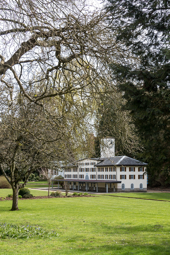
I had another free day but was not up too early, I looked at the map and considered Abingdon but it would mean a 13 mile hike, so I settled on Clifton Hampden it would make for a circular walk next with Abingdon as the mod point and a land crossing between the loop of the Thames.
I parked up at the Barley Mow car park just over the river in Clifton Hampden. They clearly get flooded as the pavement was raised in stretches. The plan was to walk to the intriguingly named Golden Balls roundabout, and get to the bus to Benson. The route would mean a 3 mike walk in land. The walk was pleasant starting out at the picturesque chocolate box village of Clifton Hampden, then round the back of the Culham science establishment, and through a bluebell wood in bloom. The sunny weather made for a pleasant walk although there was a chill wind. The timing would be tight for the bus and they pass once an hour. When I got to the roundabout I saw the bus pass it was running late BT four minites but I still missed it.
Clifton Hampden
There is a Notcutts garden centre on the roundabout so I went in there to get some coffee and cake and while away 40 minutes before heading out to the bus stop again. At the bus stop I saw a convoy of about 50 large customised motor bikes drive by. The bus did come just a few minutes late to my relief, the fare to Benson Marina was £2.20. The bus stop is in a sort of side road but cars had parked in the site road in such a way that the bus had to reverse back into the main road traffic to leave the bus stop.
View near Days Lock on the Thames
From the marina it is country side al the way to Shillington bridge where you have to leave the river then down an alleyway to the main road where for about half a mile you have to use the pavement before you can get back onto the riverside. My next stop would be Day’s lock near Dorchester, where I chanced upon a guy just about to take his boat through the lock. I took the opportunity to take a time lapse sequence, whilst chatting to the boat owner. He was on his way to Rugby to some low cost marina he had found. He did gardening jobs to earn a living and seem be a happy with his lot puttering about the country on the rivers and canals. I closed the lock for him to save him having to moor up and return.
After the previous days efforts I was keen to get back to the car, which did not take too long. The weather was just about holding out and it was still cold. This weekend I managed to get another 20 miles done and had 70 miles left to go so I was past the 100 mile point. The next walk would be a circular one taking in Abingdon which is on a big bend in he river.
I was up fairly early for for a leisurely start and to give me time to research my route and transport plan. I left the house at 08:40 and drove the B4009 to Wallingford, where I parked in the long term car park for £2, it is free after 13:00 on a Saturday. The planned bus was from the market square but I could not find bus stop B (C and A were clearly visible). I asked one of the bus drivers bit they did not know. He asked a colleague who did not know bit when I said I was after a 134 bus he said I had just missed it. I wandered over to where it had left to investigate my options, when I noticed a taxi in the rank. The driver suggested £20 to get to Pangbourne, so rather than mess around I would take him up on his offer.
About 15 to 20 minutes look later I was £20 lighter but I had saved a lot of time. The public transport option involved a bus and a train with a wait for each, a total of one hour and twenty minutes. I will try the taxi option again in future.
Thames countryside view
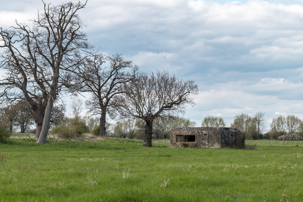
From Pangbourne, unusually the Thames Path goes up a steep hill away from the river, then when you get back to the river it is a path parallel to and high above the river on a steep escarpment. At some point I passed a pillbox, which was from WW2 when the Thames was considered a place to retreat behind should the Germans start to invade southern England.
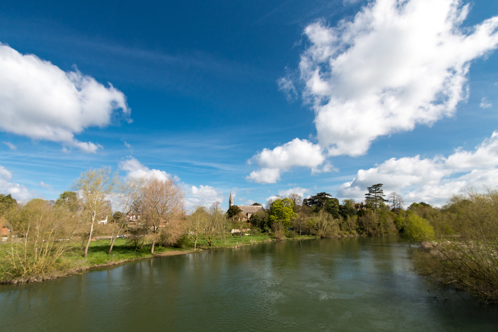
I missed a sign a mike or so out of Goring but it was only a short back track to the official Thames Path. I was in familiar territory as I had been out this way to look at Monkey Orchids at a nearby nature reserve. At Goring I fancied an early lunch and the Pierrepont cafe near the bridge did a great smoked salmon, avocado, and poached egg on toast, which I washed down with an americano.
Dining room over the Thames at Goring
Suitably refreshed I crossed the bridge and joined the path on the opposite bank, my next stop would hopefully be for a coffee at the hotel Moulsford, which I had spotted on the OS map. However the beetle and wedge website looked a bit posh for just coffee. *Set on the banks of the River Thames immortalised in ‘The Wind in the Willows’ and Jerome K Jerome’s chronicled escapades of his friends’ visits in ‘Three Men in a boat’, the Boathouse Restaurant emphasis is on quality of food, wines and service.” I grabbed a custard and chocolate bun just in case.
It did not take long to get to Moulsford, and although the hotel catered for walkers and coffee I walked on up the hill into the village, as the path did not follow the river. About a half mile of busy road was next, then a farm track took me back to the river. Just before the river I got a view of a viaduct and it seemed like a great place to get a time lapse sequence, I was hoping for a train or two to pass. I sat down and ate half my bun, which like the food at the café was excellent. Whilst I waited the 10 minutes I usually give a tone lapse a train did pass and I also watched some parachutists in the distance jumping out of a plane. The weather although sunny with clouds, was great there was a cold wind as the weather man had promised.
Thames countryside view
The path keeps to the countryside for a few miles, I heard the distinct sound of a reed warblers and stopped to watch it through my binoculars, it was my first this year. A mile or two outside Wallingford I stopped for a rest on a memorial bench for Dennis William Wilson, who liked fishing according to the plaque. The Thames had become noticeably narrower at this point, an indication that I was making progress, in fact I was over the halfway point.
When I got to Wallingford I decided to walk on to Benson to make the next leg to Abingdon slightly shorter, it felt wrong to walk past the car, and as it turned out quite rightly so. It was only about a mile and a bit to Benson lick where the path crosses the river again. My plan was to get a bus from the stop outside Benson marina. I arrived about 10 minutes early for the bus but twenty minutes late I had still not seen a bus apart from one that was on its way to Watlington. The timetable said there was a bus every 30 minutes, so I popped over the road to get a drink at the marina, then headed out to the stop with 16 minutes to wait.
The BBC weather promised cold but sunny with showers, however when I woke up the that sounded optimistic. It was grey and was threatening to rain. I was on no hurry as finer weather was promised later. I dropped Helen off then drove through the rain to Pangbourne.
It had clearly been raining a lot as there were lots of puddles on the road some starting to look like the start of a flood, as the covered the width of the road. To get to Pangbourne I had to pay £4 to cross the river. I parked up at the station car park and purchased a ticket to Reading for £3.50, and as luck would have it a train arrived as I walked into the platform, it was the 09:57 to Paddington.
Reading station is a modern building, painted mainly blue and silver, a big walkway above the platforms houses down eateries and there are escalators and lifts to move people about. It was still raining so I popped into the Starbucks opposite the station to figure out my next move. Cinnamon bun and Peru Piccino in hand I checked my phone for options to Sonning. A bus was due in 15 minutes, so I consumed my purchase and headed out to find the bus s stop. There was building going on and temporary bus stops on place, could not find the 127 stop? No but a bus employee who I asked pointed out that the 128 was pulling into the street just behind me! The driver stopped even though it was not the correct stop for which I thanked him. The one way to Sonning was £2.
Snake’s Head Fritillary
The sky was getting brighter as I alighted in Sonning village, and it was a short walk to the bridge where I could join the Thames Path where I had left off on Sunday gone.
The path was muddy grass which was slippery and hard going but it was only a couple of miles to the edge of Reading where the path became paved. On the hard to get to side side of the river was an old barge which looked like it might be sinking and was covered on top with tarpaulins. Inside out of sight was a drummer drumming away on his drum kit. In the middle of Reading is what must be a new footbridge because it is not marked on the OS map.
Pangbourne to Witchurch bridge
After Reading I passed some snake’s head fritillaries growing by the river, I’m not sure I have ever seen them growing wild. A few miles later the path because very uninspiring with the path being narrow and had river to one side and a brick wall topped by a railway on the other. I occasionally heard the odd gun shot and even machine gun fire which I thought was strange. When I got to Mapledurham lock I found the source of the shots. There was a WW2 re-enactment going on in the grounds of the house there. I had not passed any coffee stops and was hungry by that point, there was a sign at at the lane entrance to the lock suggesting a tea room being open, but it was closed which was really annoying as it was about to pour down. I had to shelter under the small roof of a notice board while the squall passed.
The last few miles would have been more enjoyable had I not developed a blister on my right foot again. I could not figure out why so I re-laced my boots as I had left a few holes out to remove the pressure on my big toe, but it had not helped. I carried on to Pangbourne which did not take long. The days mile tally was 10 miles a comfortable distance.
The stretch would be Marlow to Sonning, 15 miles by the time all the walking was done, more than usual but a good test of the effort I have been putting in. I was up at 07:00 and left the house at just before 08:00, time was tight because I thought the bus from Sonning was at 09:00. I got stuck behind lots of Sunday drivers on the way which was frustrating.
I was not sure where to park in Sonning but there was a small parking area just by the river which I spotted straight away. It turned out the bus was at 09:13 but I had a half mile walk to the main road at Playhatch roundabout, I made it with time to spare which was a good job because the bus was 5 minutes early. The one way to Marlow cost £5.10 and would take approximately 45 minutes, not too bad. A few walkers got on the bus getting on at various points, but none as far out as me, I started wonder if I was biting off more than I could chew?
Henley on Thames
I made short shrift of leaving Marlow, all paths lead to the river they say. For a couple of miles the path was a bit slippery from the recent rain which was tedious and hard walking. It did not take long to get to Hurley lock where I was able to make use of the only reliable facilities until Henley, however the cafe was closed so no coffee. I watched the canoeists enjoying the turbulent water of the weir. We then passed .section 2hixh was fields to one side and steep chalk cliffs on the other, clearly the river was very slowly inching it’s way north.
After leaving the riverside to cross an estate where i saw a herd of deer being fed, many of them in white coat, i got to Aston where the Flower Pot hotel was not yet open so I dipped put again on coffee, however back down at the River I rested for a while on a convenient bench and ate the Pain au raisin I had purchased at Marks and Spencer on Saturday evenigot
Model of St Moritz rail station
After Hambleden lock I a family in bikes were shouting at the family dog because it has dived into the Thames after a couple of mallards, no soon had it got out of the water it was off across the fields chasing some more, much to the dismay of the patents and embarrassment of the children.
There is a big clue that you are approaching Henley the river widens and becomes very straight with a buildings in the distance. As you get closer you can see the rowing clubs and fields for the parking required. My feet were feeling the miles at that point and I was in no mood for extra foot steps so I dipped into the first cafe I found. It was packed but my order was taken and delivered swiftly. The coffee was great and the Haloumi and pesto/tomato sandwiches hit the spot, although it occurred to me that the salty cheese might make me thirsty later.
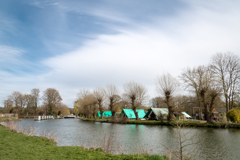
Sheds and Tents on the Thames
I soon got away from the crowds of Hnely after passing the national rowing museum, on the riverside on the out skirts. Then it was rural for pretty much all the way to Sonning. Not far out of Henley there was on the far bank a traditional boat house and near by on the same property a very modern house. Although you pass Shiplake on the path you really are no where near the village it self and it’s amenities. As I walked the last few miles I started to feel the length of the walk, mainly because I was suffering from a blister on my right foot, and I think as a result I had changed my gait which was causing leg ache. Add to that my thirst as a result of the salty cheese, it was not an enjoyable 3 miles.
Sonning could not come soon enough, and it did not take long. I found the car again ok, and had to stop for two drinks on the way home to satisfy my thirst. Moral of the story is that 12 miles is the sweet spot not too long but a reasonable distance. Looking at the books when I got home I had almost reached half way, and had less than 100 miles left to do. The next few legs would get closer to home.
I was confused over the distance from Windsor to Cookham, I got it in my head that it was 15 miles but it turned out it was only 10, so a nice distance. A work colleague lives in Cookham, so I sought advice re parking. I aimed for being in Cookham at 09:00, as the buses worked at that time. For the first time the satnav did not suggest the M25 so I went via Beaconsfield, cross country.
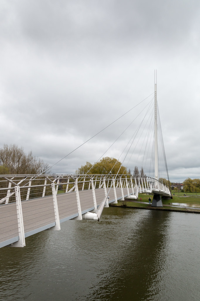
I parked up and found the bus stop and by chance Max was there, and offered me a lift to Windsor, what a star. We walked back to his house and uncovered his convertible Mercedes, I would arrive in Windsor in style thanks to Max. I started at the Riverside station, and ignoring the map did not cross the river so I did a 1/2 km detour having to double back. My first stop was Boveney Lock to start this blog entry, usually I got the chance on the bus or train.
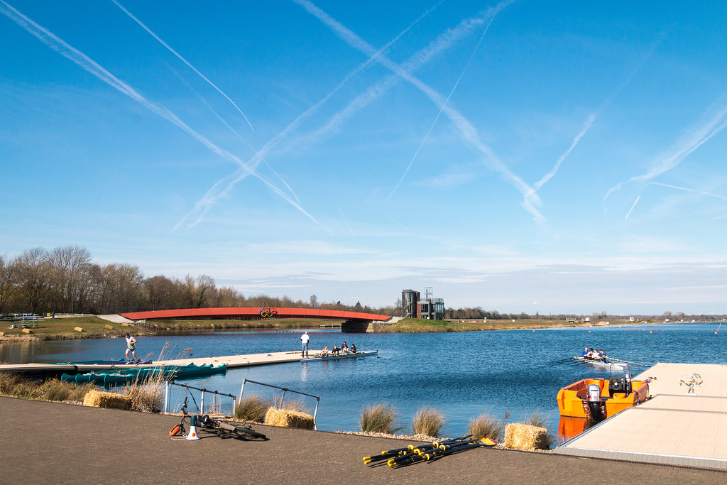
Dorney Lake Olympic rowing lake
At Dorney Lake I cheated by taking a very slightly short route taking in the Olympic rowing venue, there was a lot of activity going on, with rowers training and a Triathlon, just finishing. I say cheating but in the very loose terms, because my plastic map of the path takes you that way because when it was printer the path had a detour. The weather had turned out gorgeous, blue skies with con trails building as the morning went on. I was down to my T-shirt, but it was cold when stopped. At the end of the lake where the Triathlon had taken place a coffee stall was still open so I stopped for a coffee, I was at mile 3.88.
As you approach Maidenhead the Riverside houses are very opulent, I imagine they run into the millions of pounds. Quite a few own the bank but the foot path cuts the house off from the river. Just before Maidenhead you pass under the brick railway bridge built by Isambard kingdom Brunel, it has the widest and lowest self supporting brick arch. It looked to me like it needed a bit of TLC there were bushes growing out of it.
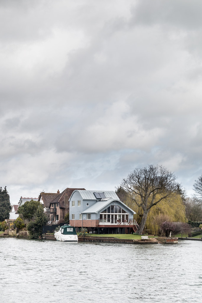
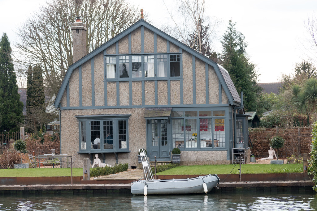
Barge on the Thames at Cookham
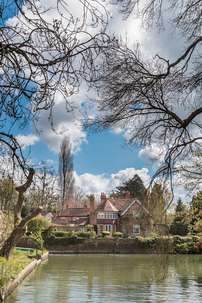
At the Maidenhead bridge at Windrush VW (where I bought my Golf) I crossed the river and stopped in the Blue River Cafe for lunch, of Toast vegetable and Haloumi sandwich, which came with chips, I washed it down with a pint of orange and soda. While munching away I spotted my first Sand Martins of the year, as well as a Grey Wagtail. Unusually I started to get a blister after Maidenhead and my pace slowed a bit. Opposite Cliveden I rested for 5 minutes on a handy bench, it was peaceful and quiet until two elderly ladies came along and sat down and started nattering to each other.
I tried to contact Max as I got back to the edge of Cookham, but had to leave a message. Once in Cookham I took a look at the Stanley Spencer Gallery, which is £5 to look round but worth it as the paintings are curiously interesting, they are slightly impressionist and often contain the depiction of some biblical scene. By the time I had looked around the gallery Max still had not contacted me so I headed back to the car, then home.
I investigated my blisters when I got home they were not particularly large but they we deep and in an awkward position on the ball of my feet right near the base of my second toe in. I was using my new lined socks from Tesco which were fine on the first outing but had subsequently bee washed, the lining and the out seemed to be fused together and resisted being pulled apart. My theory is that the linings should slide over each other to stop the skin being stressed, and the lack of that property caused the blisters. I will revert back to my old thin silk lined socks that I wear over normal day socks in future and make a note to source some more. I bought them from an outdoor shop in Liverpool Centre more than 10 years ago and they have served me well I only hope I can find a replacement.
I was hoping to get in a couple of stretches of the Thames Path over Easter but due to various commitments I did not get a chance until the Sunday, and Easter Monday looked like it might be a wash out due to the remains of hurricane Kate passing through. The clocks went forward so I lost an hour, but I was still in Windsor by 09:45, to catch the 10:12 train to Staines. The car park at Windsor station is a bit of a ball ache after I had rustled up enough change for the meter after poking around under the car seats, I fond out that the reason there was a queue at the machine was because it was credit card only and the slowest machine in the world.
Finally when I got to the station and had purchased my ticket (£4.40) I found out the train was cancelled, luckily the next train at 10:23 was fast one so little time was lost. The weather was clear and great for taking photos, but there was a brisk breeze and a chill in the air, so I was happy to sit on the train for 20 minutes before it left the station. The forecast was for heavy showers so I had my poncho with me as well as my camera bag to keep things dry.
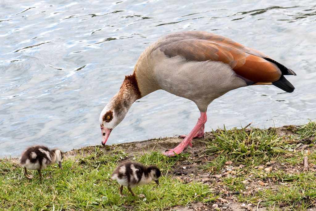
Egyptian goose with young
Today’s walk would be less than the usual 10 mile minimum, but the next convenient stage would be Maidenhead, but that would be a 15 miler, tempting but the boat race was on and with the prospect of a choppy river due to the wind I wanted to watch it on TV. It was ironic that the race was on and I would be walking a different direction, with a bit of planning it might have been an experience to walk the race section with all the crowds about.
The day would be a mix of sun and rain, which I was soon reminded of when a downpour had me sheltering with some team supporters of people doing the Devises to Westminster canoe race. The sun soon came out and dried my poncho. On the way I saw some parakeets and a kingfisher flying away, then amazingly I saw an eagle owl in a cage in someone’s back garden.
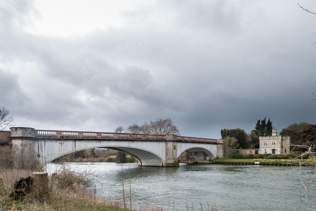
Bridge over the river Thames
I was caught out again after a bridge crossing at Windsor great park. It really lashed down with hail and everything, the poncho provided little protection and neither was there any around, so I plodded on until Datchet where it stopped and I popped in for a coffee and sandwich at the Costa coffee. It was 14:00 so time was a bit tight for the boat race, I had an hour to get to Windsor, so I did not linger too long at the coffee shop. Despite more rain I would have to walk through it.
It was not far to the station and my parked car. The traffic on the way home was quite busy so rather than M25 I peeled off onto the M40 and went via Beaconsfield. I was back in good time for the boat race but I missed the women’s race which was the one to watch as one of the crews nearly sank.
Unusual house on the Thames with unusual ornaments.
The weather was sunny and Helen fancied a quiet day pottering around the house, I um’d and ah’d about a local walk but settled on another section of the Thames. You can get a bus from Staines-on-Thames to Sheperton and it takes 20 minutes. The walk would be less than 10 miles but would get me almost to the M25 which would be a milestone and Staines would be easy to get to for the next leg which would take me to beyond Windsor and Eton.
I arrived in Staines-on-Thames at 10:25 and parked up at a car park opposite the bus station, but the next 458 was due to leave at 10:59, so I had a mediocre coffee at Coffee Corner at the entrance to the shopping centre. The 458 was on time and I was soon back at Sheperton train station, and walked down to the ferry where I had finished the day before.
Polar bear on a balcony at a house on the Thames
Guessing that the path would be muddy I wore my walking boots it was a good choice as the path was muddy at times. At Laleham I took a slight detour in land in search of a coffee shop, but found nothing, I had to settle for an oyster from and ice cream van at Penton lock. I had spotted a few strange fibre glass objects on houses since the start of the walk, some sun having shop mannequins, a Stan Laurel, and finally just before Penton lock a polar bear. Whilst eating my ice cream quite a few two man canoes were portaged round the lock it appeared to be a race as they were mainly jogging and support crews were on hand with energy drink and treats.
It was less than two miles to Staines-on-Thames and was done quite swiftly. I toyed with the idea if walking a bit further but saw a sign that said 10 miles to Eton, which was perfect, I’m sure I saw a bus service to Eaton from Staines. Just as I got back to hr cat it started raining as promised by the BBC weather service.
It started out a cold day, when I got up at 7:30 it was snowing, however this just mean that the promised frost did not appear so the car windows did not need scraping. The plan was to attempt to walk from Teddignton and to use the ferry at Sheperton. I parked up near the ferry on the Weybridge side, the rules of the ferry are that you should ring a bell changed to the jetty, but only on the quarter hour. I arrived at 5 past 9 so had a 10 minute wait. I rang the bell a few times s but no one came so I rang the number on the sign, a polite man answered and apologised for not hearing the bell, because the chandlers shop door had been closed. The £2 one way fee was swift due to the two outboard motors. He had to dodge a few rowers and canoeists who were holding some sort of slalom event in the weir.
The walk to the station was 20 minutes and I found a handy Costa coffee just before arriving. The ticket to Teddington was £4.40, not bad I suppose compared to previous Thames sections. The journey took 20 minutes, and I was soon back at the footbridge at Teddington where I had started a few weeks back.
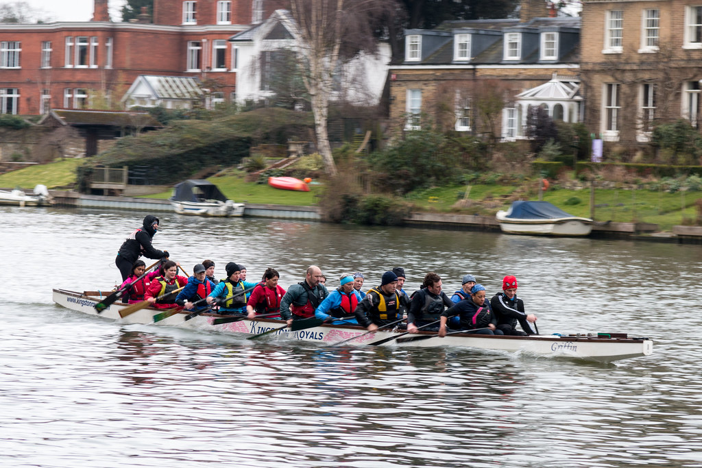
The Kingston Royals
I crossed the river again at Kingston. Parakeets were everywhere, and I heard a loud woodpecker a clear sign that spring is imminent. The path splits into two a high road and a low road, I took the high road because it was not muddy. Both followed the Thames around Hampton park in a big curve making it a sort of peninsula.
I took a wrong turning using a gaye into the Hampton park and had to retrace 300m, then I found the right gate and was happy to see that the cafe was available in the non-ticket area. I had egg and cress with crisps and a coffee. They had free water either iced or lemon sliced. I welcomed the rest I was 6 miles out and not quite half way. I visited Hampton court some years ago and can’t remember too much of it, but from the outside it looks grand, I made a mental note (and clearly a typed one too) to take the time to visit again.
I crossed the river river at Hampton not far from the entrance to the court,I would stay on the southern bank AL the way back to the car. At Molesey there was a lot going on, a relay running race and lots of rowing. There were a lot of house boats and water from chalet type residences as well as high end mansions on the Northern bank.
Mythical beasts
I had a plan to stop at the only possible stop on the path back to the ferry, a pub at Sunbury locks. I reached the locks but there was no pub, there were buildings that could have been pubs but no pub. You can imagine my joy when just after the locks there was the pub, called The Weir, a freehouse to boot, I had a half of Twyford Tipple and a packet of Jalapeño crisps. A chance to test my feet was very welcome and I only had about 20% of the distance left to walk. It was starting to look a bit greyer outside which reminded me that rain was due early afternoon, the time was 14:00.
The final stretch was not to bad and the rain held off. The path was really in the country side now. I got back to the car and thought I would take a look at the chandlers over the other side of the ferry they had a sale on. I had to go back to the bridge and down ferry road to get there. It turns out it was not a chandlers but was full of cheap clothes and nautical related tat. There were a couple of weather stations going cheap at £25. I moved on then stopped at a Snow and Rock shop outside which cars were hunting for parking spaces. I had a look round but even the stuff on sale seemed expensive.
The walks are becoming easier my feet do not ache as much and I think I can easily do a 15 miler if I needed to, but I will keep the stretched to 10-12 miles but push out longer if it seems appropriate.
Sunday was my opportunity for a walk so I went to bed early for an early start. We got new neighbours on Saturday but we have not really heard a peep out of them yet. I drove to The London Wetland Centre at Barnes and is run by WWT. They have free parking but the sign at the entrance suggested a £10 “donation” would be required if you did not have proof of entrance tickets on exiting, I took a chance, and in any case they do good work so would rather pay them than a car park.
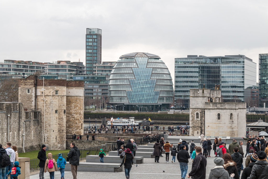
The plan was to walk to Mortlake then public transport my way to Tower Hill then continue where I left off last week. By the time I got to Mortlake I had walked 4 miles, and I realised I may have bitten off more than I could chew. I threw caution to the wind I would see how I got on, and made a note to improve my map measuring technique.
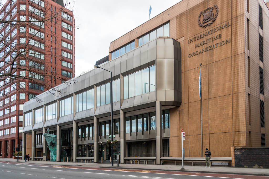
International Martime Organization
I had a message from a friend last who I had not communicated with for some time, but whom I have known for man years, and we always seem to be able to carry on where we left off. Anyway he had read the blog, yes people do read it and asked if he could join me for a section near Oxford, I jumped at the chance it would be great to meet up again. It would probably be warmer by the time I get that far, and having access to another car would save buses or doubling back.
I splashed out £12.10 on a travel card as I was not sure what i really needed then got the South West train to Waterloo and then the Bakerloo for a stop and jumped on the District line to Tower Hill. I planned on walking for another hourish before a break for lunch.
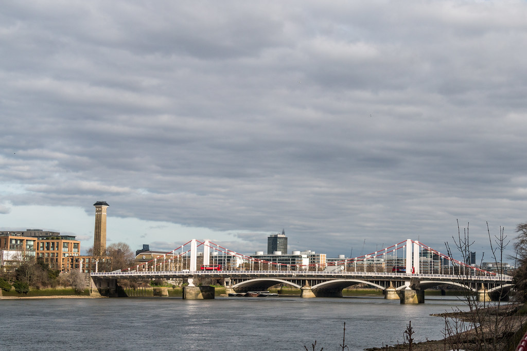
Chelsea Bridge
The Southbank Centre seemed like a good place for some lunch, egg sandwich and hot chocolate, and evaluate the distance left. It turns out there was another 8 miles back to Barnes further than I ideally would have preferred but doable, that remained to be seen however, but with rests at arcticle points I should be OK. I left the the Festival Hall at 12:40.
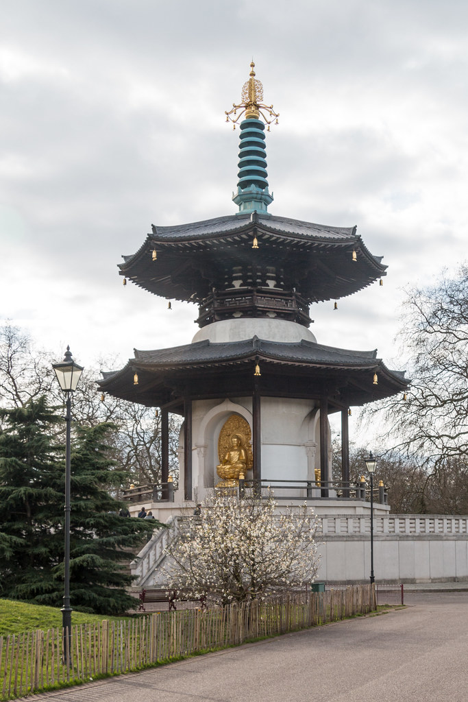
You start to leave the tourist crowds behind after the Houses of Parliament, so the walking starts to get a bit easier, I put a spurt on for a bit to get some ground behind me. At the bridge before Battersea I crossed over to avoid a hike in land around the old power station. I upped the pace again though Battersea park where I passed the Peace Pagodas. At the village I was forced in land by a path closure, and took the opportunity to stop for a well earned coffee and carrot cake. The cake was a double portion there was a clear portion line down the centre, however two slices was just too much for me.
Peace Pagodas
After Putney bridge is an area where Londoners go to mess about on the river.There were lots of people in rowing boats and some evidence that sailing went on too. I think there were races going on as there were a couple of launches with load hailers.
Back at the Wetland sensor was obvious that the parking would not be free as you needed a token to get out, so I went to the entrance and purchased one of the £10 tokens. This Thames walk is becoming an expensive task, what with the petrol, coffee stops and the rail ticket today it probably cost me over £50! The total distance today was 15 miles and and managed to fill in a gap I now had a continuous stretch of about 40 miles of the Thames done. Only 140 miles to do.