Ricoh Theta, Google photospheres and Pannellum

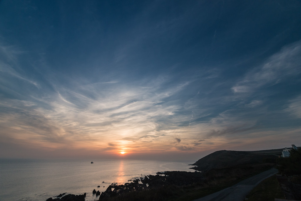
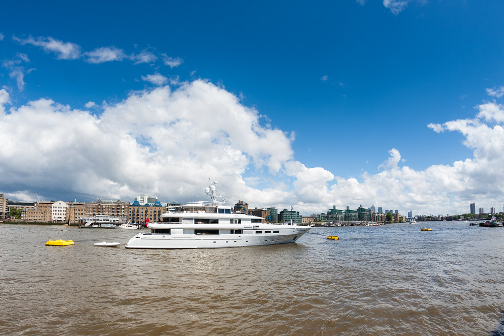
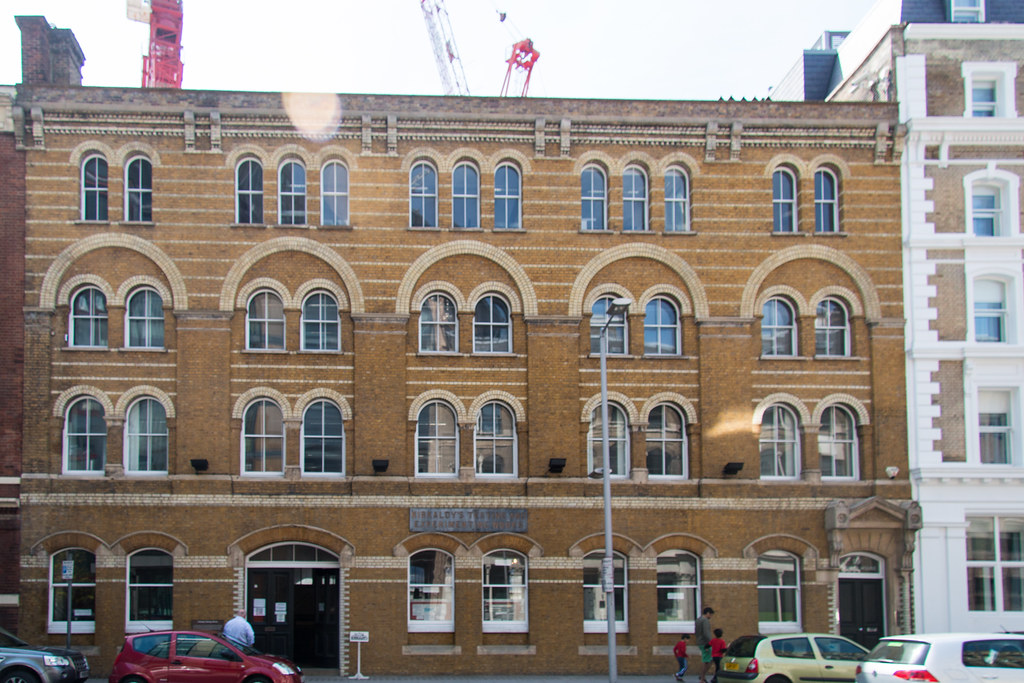
I have a new Gadget a Ricoh Theta it is capable of taking full 360 degree panorama with one shot. It does this by have two lenses pointing in opposite directions, each one with a slightly more than 180 degrees view. The camera then stitches the two pictures together in the camera. The resolution is not great at 3584 x 1792 but they are good enough to publish on web pages as you can see from the example below. The camera have been out for over a year but have they are quite a niche thing and not that easy to get hold of. You can get them new on Amazon and eBay for about £320, they come from Japan, but I spotted a second hand one of eBay I put in a bid for just over half the new price and forgot about it. Next thing I know I have won the auction and a proud owner of a Ricoh Theta. I checked out the images on the camera when I got it and get the impression that the person that had it before had not used it much there were a dozen photos on it starting with some test ones I’m guessing it probably only ever took the 12.

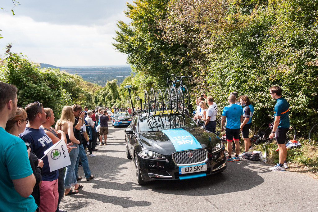
I have been carrying it about for a few weeks now in an attempt to get get a feel for what pictures work and what does not. You need to be a bit careful with which way you point it because you can end up with side dark and one light, so I try to keep the sun to the side so that each camera get the same amount of light. Another issue is that it is impossible to take a picture that does not include your arm, hand and thumb on the camera button, but there are a couple of solutions to these issues, the first is to get a selfie camara holder basically a telescopic stick with a tripod mount on the end, this puts you further away from the camera so taking up less room in the picture, the other method is to use the phone app to take pictures remotely using wifi.

I have an Android phone and there is an app in the Play store for the Theta, which appears to be pretty robust. The Ricoh Theta has built in wifo and acts as an access point, which you pair with your phone then you can access the theta to download and share your photo’s. You can also take pictures remotely, and have a choice of Auto mode, Shutter priority and ISO priority and you can adjust the exposure -2.0 to +2.0EV in 1/3EV Steps. You can also do interval shooting which would be useful for timelapse or hyperlapse sequences. As I said the resolution is not great especially when you view the images full screen but it is really convenient and I and sure to have some fun with it, and the price was good.

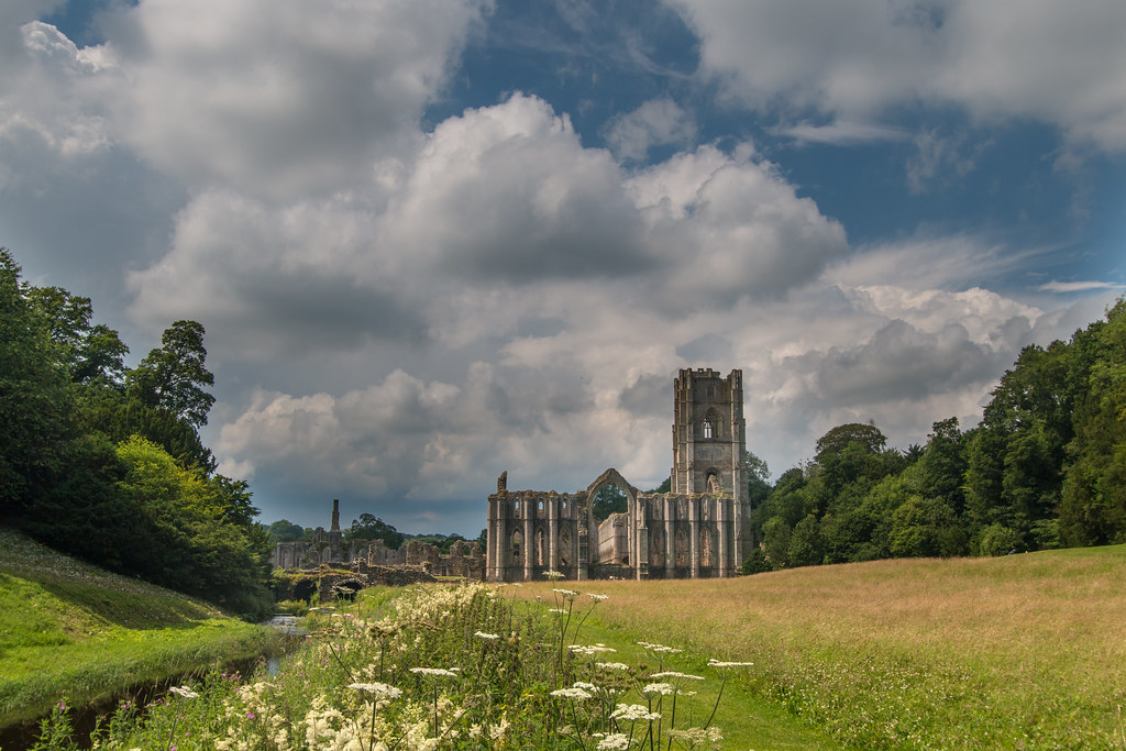
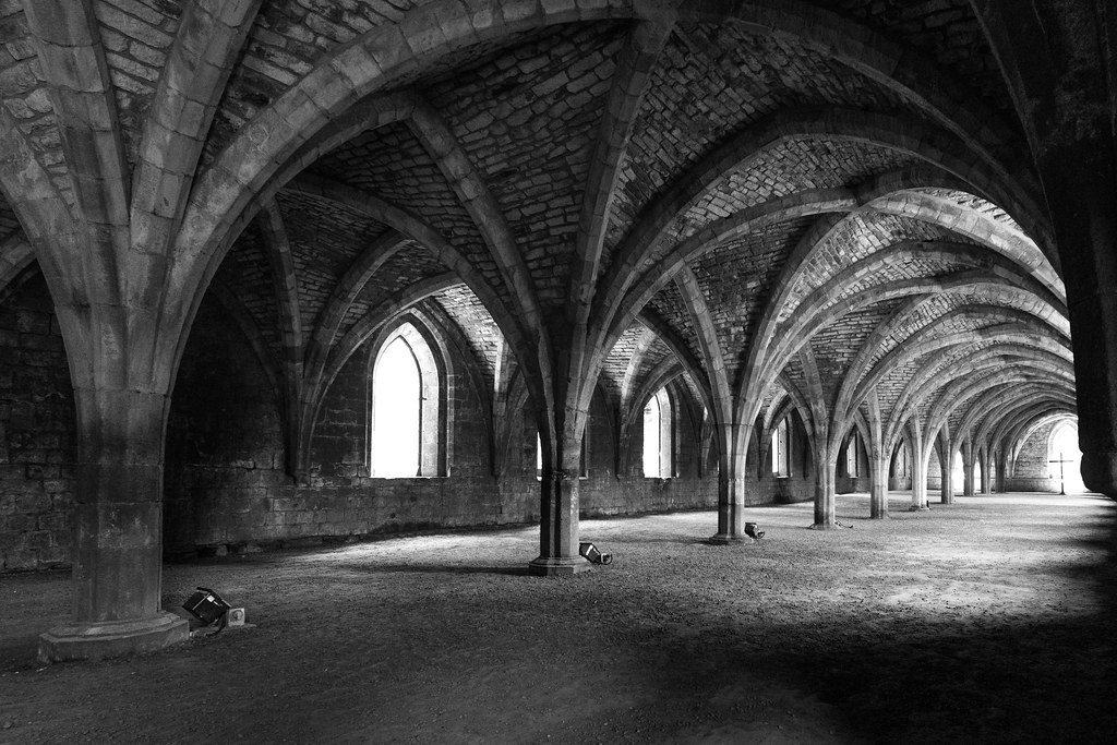
I also create panorama pictures by stitching together photo’s using a product called PTGui, my strategy is to take three sets of photos, 6 around at 60 degree intervals and then one up (the zenith shot) and one down (the nadir shot), the sets are at different exposures -2.0EV 0EV and +2.0EV then the software stitches them and uses the exposures to produce an HDR image. The best way is to take the pictures using a tripod and a special bracket which allows the lens to be rotated around the Nodal point of the lens, which avoids parallax issues. However carrying around a tripod is a pain so I also carry a plumb bob and use that to get as close as possible. I have the Pro version of the software so I am able to make corrections for the view point of the camera, which is needed for the plumb bob method as well as the  Nadir shot of the tripod method if you want to avoid having the tripod in shot. The brackets can be expensive circa £250 but I managed to make a reasonable one from an ABS pipe coupling, and a tripod and a quick release adapter.

Finally I needed a way to be able to easily display the panorama in all their glory on my site. You may have noticed that in a previous post http://neilbaldwin.nettarka-trail-bike-ride/ I had embedded some photospheres from Google which had contributed to Google Street view, I did not like the way that they were presented and they don’t always work on iPads etc. I have been looking for a pure HTML 5 solution for a while now. There are quite a few commercial packages with lots of features but I just wanted a simple solution, and the other day I found one it is called Pannellum it is open source and free of charge and does the job nicely. It took me a while to get it sorted working out what should go where and the best size for the images. One thing that threw me was that images on flickr threw an error but it turns out that Flickr is the one at fault because they return a strange thing in the get requests which makes the browser complain about a cross site scripting error. Anyway it turns out that images on Google work fine and I publish  my photospheres there any how.

My next project will be to create a PHP function to use the code so that I can publish my collection of Church photospheres on a dedicated website. I want to store the the details in a searchable database so that people can search for churches and then see the inside of them. you will need to watch this space for news of that project, but in the mean time you can see the waiting images on my Google plus site here https://www.google.com/maps/views/profile/116324611784531709687?gl=gb&pv=1&tab=1 enjoy.

A circular walk from Croyde to Sauton and back

Croyde sunset

Three of us (the men) decided a walk would be preferable to a shopping trip, so we thought a walk to Suanton Sands for lunch and back again looked like a good idea. We headed into Croyde and then hit the beach and headed up between the dunes where the stream flows onto the beach, from there you can pick up a foot path that heads to the center of Croyde, along Carpenters Lane, rather than having to walk along the road. When we hit the main road J went to grab his Telegraph from the post office while T and I waited.

Head out of Croyde by taking Cloutmans Lane which turns into Milkaway Lane, perhaps because they used it to get the milk to town possibly? Take a right branch onto Pathdown lane, a suitable name had we been going in the other direction. It was a steep climb but meant that we got all the hard up hill out of the way at the beginning of the walk always the best option in my opinion. Eventually you get to the top of the hill which is wide and round, but at the very summit you have views all around. Over the top the foot path signs are mounted on large gate posts we speculated whether people ogt lost in the fog up there and whether veering off the path could lead to a fall off a cliff.

It would be mainly down hill from now on, we headed down to Saunton Court a very large house with a very manucured expansive lawn and garden, where you walk down the drive and eventually get to the main road at which point (according to the map) there was a vague path which you could pick up if you walked into the golf course club house area. We were a bit worried about being told to get out of the golf course but followed the road to the clubhouse then the signs to the driving range, were a trodden path headed down the back of some houses and parallel to the road and in the direction of the cafe at Saunton Sands.

View from Motehoe Point Devon

It was time for lunch so we decided on the Cafe with the terrace who were more than happy to allow the dog. The cafe is run by the Hotel above and the smart waiters in all black seemed very good at their job. I order a coffee to go with my Smoked fish anti-pasto platter/starter, Mr T had the meat anti-pasto and J had spaghetti bolognese. The food took quite some time to arrive but the sit down after the long walk and the lovely weather was welcome anyway. The food when it turned up was excellent. I managed to leave my phone there when we left but realised very soon and was able to retrieve it by retracing only 100m or walking.

Again the walk started with a steep section up to the hotel over the road onto the foot path which climed a bit more to get above the road which it followed all the way to the end of the finger of land which ended at Downend, where we had to turn the corner and then walk back the way we cam up the road for about 75 yards, to follow the coastal path around the point and onto the beach at Croyde. We crossed the beach on the harder sand hwere the sea had been at high tide for an easier walk. Back at the hut we had a peaceful rest of the afternoon updating blogs and reading.

The ladies had followed us to the Cafe at Saunton and the service was even slower for them they they waited an hour while the waiters forgot their order then they were given their drinks for free as an apology. We had fish and chips for tea from Braunton.

Activity number three sea kayaking near Ilfracombe

Croyde Devon Beach view

Mr T fancied some sea kayaking and C was up for it, I threw myself into the mix we had the minimum of three people required for a couple of hours paddling along the coast. The rendez-vous was at 12:30 in a car park at Helle Bay just the other side of Ilfracombe. We had a leisurely start with the late appointment and took our time over breakfast. I filled some of the time taking some local panorama photo sets.

The drive to the Helle Bay took only 30 minutes compared to our estimated 40 minutes so we were very early. The guy taking us for the paddle was a bit early too. We were soon into our wetsuits but I had managed to leave my car keys in my shorts pocket, so a partial wetsuit removal was required. We had a fairly long walk to the waters edge carrying kayaks which made the arms burn a bit a good preparation for the paddling? Once there we had the obligatory safety brief and instructions on what to do in the very unlikely event that we were to fall out of the kayaks, and that a clenched fist means I need help.

We jumped in the kayaks and headed out to sea, the water was a bit choppy compared to the mill pond we had left over in Croyde. We were about a hundred yards out when C decided enough was enough the kayak seat did not suit her hip and could not last two hours on discomfort. We paddled back in then Mr T and I then shared the double and headed back out again.

Croyde Devon Beach view

The seas was quite choppy and paddling was hard again the wind and out of the bay to the north but once around the corner and in the lee of the wind it was much calmer. We kept close to the shoreline and worked our way in and out of the rocky shore. The guide also took coasteering parties around the area so knew his way in and out of the inlets. After about 45 minutes we turned around the plan was to head across the bay and south towards Ilfracombe. The sea was now more choppy but with the wind behind us we were soon across the bay, and into the rocks. The wave direction and currents between the rocks meant were were whisked along just passengers. I remember thinking it is going to be hard work paddling back against the current and wind. We did some more looking at the rocks and visited a couple of caves one with an interesting circulr poo which was called the washing machine, then headed back.

We had to paddle hard to get through the worse bits and then turned around and landed on a beach for a rest while the guide explained how the rock arch we were near had partially collapsed during the severe winter storms of 2013/14. The break was welcome I had not realised how much of a strain sitting and paddling was on the core, my upper leg muscles were glad of the 5 minutes rest. We got back in the kayak for the final push to shore we had to cross out into the middle of the bay to avoid the waves crashing on the rocks to the south of the bay, but this mean that we had to paddle against the swell, which when you are low in a kayak seem much higher than the are, they looked about 5 foot but probably more like 3 peak to trough. We obviously survived and being back on dry land was welcome.

We went back to the hut and then had a leisurely rest for the remainder of the day. We had pasta cooked my myself.

Stand up surf boarding SUP

View from Motehoe Point Devon

Against my better judgement I agreed to have a go at SUP (stand up surfing), which is basicslly standing on an over sized surf board with a a paddle. I imagined that I would spend a considerable amount of time climbing back on to the board then, attempting to stand up followed by falling off the baord and starting the whole process again.

The lesson was booked for 10:30 which was arounf high tide which was very convenient as the seas would be closer to the top of the beach and therefore less of a walk with a large surfboard to get to the water. They booked us in and got us to sign our lives away using the insurance indemnity form, issued us with a wetsuit of roughly the right size. Getting the wetsuit on was a bit of a struggle as I am not a regular user but despite it being damp and clod I managed to get the thing stretched over my body.

Next was the obligatory briefing where they explained that we were about to stand on a surfboard and use a paddle to move about, and that the sea was a dangerous place and should be respected, in fact it was like a mill pond. We carried the boards down to the sea which take quite and effort there is a handle at the center of gravity of the board, so basically you can only use one arm to carry it. I had to stop a few times to rest my arm.

Style on footpath above Croyde Devon

Once at the waters edge we had a another brief this time on the techniques, i.e. how to get on the board (we knew how to get off) how to use the paddle how to steer etc, eventually we were allowed into the water. It was not long before we were stood up on the board which turned out to be not that difficult, but it was also not long before we learnt how to climb back on the board when we were out of standing depth. The wind was blowing off shore and because our technique was poor meant we were soon quite a way from the shore. Andy out instructor encouraged us to practice the turning technique he had show us and head a bit closer into to the bay.

We spent some time paddling, falling, standing up and I was soon glad they the lesson was only for one hour, as towards the end it was becoming a bit of an effort climbing back onto the board, as the falling in became quite frequent as I was attempting to use the small breaking waves to “surf” towards the shore, but mainly failed to do. Luckily we only had to carry one of the boards back to the surf school building as there was one guy on the next lesson.

Back at the hut we had a coffee and a sandwich then Helen and I headed across the bay to do sme ook pooling and panorama photo’s. John was on cooking duties and we had giant stuffed butternut squash, veggie sausages and green beans which was very tasty.

Real day one of the holiday in Croyde

Sea view from Saunton Sands

First day of holiday has to start with a good walk with a view of the sea today would not be and exception. We were up relatively early after a sensible time going to bed. A leisurely break fast saw myself, Helen and Helen’s dad leave the house at 09:30 heading north up the coast path around the headland to Pulborough sands, where we had a coffee at the campsite/seaside cafe.

The return journey took us over the headland and down a very old track, you could see three ruts in the bedrock, one in the middle wide and shallow and two eaither side narrow and deep, clearly made by a horse and cart. We also spotted many Red Admiral butterflies feasting on the flowering ivy plants which they seem to love. Apparently they migrate back to Morocco when they have had their fill.

In the afternoon I had a walk across the rocks and then the beach with my camera, and took a panorama set looking back to land which turned out better than I expected. The sea was quite calm so the surfers where not getting a long run in, but I guess it was ideal conditions to learn. Back at the hut we decided to pop to the Manor pub in town which looked good from the menu we found on line, but in reality the food was not great, I like to think that it was probably because it was a Sunday and the pub had been busy all day.

Tour of Britain and start of holiday in Croyde Devon

View from Kop Hill

The tour of Britain was passing through the area and I had the day off so I thought I would go and have a look. After consulting the maps for the route I figured Kop Hill, a category 2 climb, would be the best place to see them as they would be going slower on the ascent. I figured that parking spaces would be at a premium in the area so I needed to have a plan. Looking at the ap there is a parking area about a mile away on a parallel road with a foot path leading to the whiteleaf car park.

Before heading out for the race I had and appointment with Roman Britain. There was an open day on Bishops field where an archaeology dig has been going on before a new housing estate is inserted into the space. There is an obvious track way across the field where the ditches which bordered the road showed up darker. The road was part of the Icknield way. They had some interesting finds on top of the usual bits of pot and animal ones they found a skeleton of a woman and in another spot the skeleton of a small child. I met up with Helen and parents to have a look around, and gave them a lift home on may way to Kop Hill.

Tour of Britain Bike Race 2014 on Kop Hill Buckinghamshire

On the way to to my parking spot, i had to negotiate many cyclists down the narrow country lanes. The parking area was about two thirds full probably unusual for a week day, so others had probably had a similar idea. The foot path was a familiar as I have walked in the area quite a few times in the past. It took about 25 minutes to get over to the whiteleaf parking area and I was glad that I parked else where as the car park was overflowing on the road leading to it. A short walk following the crowds that were gathering got me to the top of Kop hill where I walked down a few hundred yards to get to the steepest section, whch would make getting photographs easier as the cyclists would be going a bit slower.

It was not long before we saw some action, marshals and police on motor bikes and the odd official car drove ast and everyone cheered them by. There was not much room on the road due to spectators and it was not yet closed to traffic s the odd car tried to negotiate us who were spilling on to the tarmac. Eventually the motor bikes and cars got more frequent then word went out that there was a break away 6 minutes ahead of the bunch, and they were not far off. As if on queue they then appeared hauling them selves up the steepest part of the hill, then some minutes later the buch appeared passed and then the stragglers trying to keep ahead of the broom wagon passed followed by all the team cars and it was all over and very everyone started to disperse. I walked back to the car headed home again negotiating cyclists on the way, my next job was to pack for our holiday week in Croyde Devon.

Sky team car

Fairly early start on Saturday we picked up Helen’s parents and the dog and got away on schedule at 10:00, destination, Clevedon and Tyntesfield National Trust, which was just past half way on the journey and beyond Bristol a pinch point for M4/M5 travellers. We made good time and the roads although fairly busy kept moving all the way until we turned off towards Tyntesfield. Helen and I had been to Tyntesfield before when we had the good fortune to be able to say the weekend in the house when R who works for the National TRust was house sitting to give the property manager a weekend break.

We arrived at the house from a different direction the last time we visited from above the house on the Farm side, where they had built a large parking area. The place was pretty familiar as I had previously been for a run around the grounds. We headed straight to the cafe for a coffee and to get a slot to look around the house, we managed to get a 13:00-14:00 entrance slot which suited us perfectly. After coffee Helen loked after the dog while went with her parents around the house. The house was exactly as I remembered it not much had been moved, and I even got to see the bedrooomwe had used those years ago.

I managed to get a few panorama sets one f the chapel which although needs some further processing came out well, despite the low light, people in the way and having to hand hold the shots. We found Helen outside the cafe, and we left the property at 14:30 which would get us to Croyde for a bout 17:00. The going was good n the motorway but we got stuck behind a few lorries on the single carriage road, with very few overtaking opportunities. We arrived at the house just before 17:00 the sat nav took us down some very small roads for the last couple of miles.

I cooked a really tasty minestrone soup for tea the recipe came from the Guardian saturday cook section. It was mirepoix with tomatoes, green beans, grated courgette,canneloni beans, and spinach stirred in at the end, it was a very hearty soup with not much stock. I will most likely do the soup when we are home and freeze it for eating during the week.

Fountains Abbey

Fountains Abbey Studley Park Yorkshire

On K and R’s recommendation we headed back up the M1 heading for Foutains Abbey near Ripon, we were a bit worried that there might be a lot of traffic because the Great Yorkshire show was on near Harrogate. Fountains Abbey is a world heritage site and certainly deserves the accolade. Wikipedia says “Fountains Abbey is one of the largest and best preserved ruined Cistercian monasteries in England. It is located approximately three miles south-west of Ripon in North Yorkshire, near to the village of Aldfield.”

We parked up in the two thirds empty car park, and walked to the entrance and information centre with National Trust shop. The site is vast and consists of the Abbey ruins a house and many acres of landscaped gardens with water features. The lanscapped gardens have large lakes with statues of greek gods. It was a short walk down hill to the abbey ruins, and we stopped at the mill cafe for a coffee and to grab some sandwiches for later. We wandered around the ruins taking it all in. There were plenty of people oj guided tours an I heard quite a few foreign languages clearly a popular tourist venue given the world heritage status.

The Cloisters Fountains Abbey Studley Park Yorkshire

Taking photo’s was quite a challenge even though I had my wide angled lens with me it is difficult to keep the verticals parallel whilst framing the picture well. I also took some panorama sets which I hope will prove popular on Google maps. We were also there in the middle of the day and the sun can prove to be a bit harsh and bright in July.

We wandered around the lakes stopping halfway for a rest and time to eat our sandwiches, sat on a bench while the world walked by. I left the GoPro on the bench arm taking a picture every 2 seconds for a timelapse to be stitched together at a later date. We stuck to the shade for the walk to the far end of the lakes as it was very warm in the sun. At the end we headed out the gates as we wanted to take the alternate route back via the church we had been recommended to us to take a look. We were not disappointed and I wished I had a tripod with me to take a panorama in the church. Note to self investigate good light weight and small tripods at a reasonable price.

I decided we should take the long way home across the dales. We headed west towards Pately Bridge, and drove through a heavy rain storm which saw torrents of rain running down the steep roads to the valleys at the bottom. The views after the rain had stopped were stunning, but we did not really have time to stop. I made a mistake and took the turn to Ilkley rather than Keithley which  mean that we had to drive through Brighouse and Bradford and Huddersfiled to get home, and it was the rush hour to boot. The journey home took 2 hours compared t one hour to get there.

K treated us to Pizzas for tea.

Walk to HMS Bulwark from Rotherhithe

HMS Bulwark

London seems to be a weekly commute for me at the moment. This Saturday I have managed to get tickets for a tour of the Navy ship, HMS Bulwark moored up in Greenwich for a few weeks. To make a day of it I thought I would walk from Rotherhithe which will complete the walk I started last weekend when I walked from Rotherhithe to Tower Bridge.

Waiting at Berkhamsted there were quite a few groups of people with picnic hampers clearly some outside event was on. The train was relatively busy but I got a seat with a table for the coffee I purchased on the platform. The train was running 7 minutes late.

I chose to tube it to Rotherhithe, then I kept to the Thames path as much as I could, it turned out to be quite a long walk and at Deptford high street I thought about getting a bus but the next one was in twenty minutes so I carried on walking. By the time I got to the Cutty Sark I was quite tired of walking. There was a sort of French market on and I bought A veggie quiche for lunch the whole transaction done in French. I followed that with a coffee and a pee at the Greenwich  museum the cafe was a bar as well and brewed its own beer in the big atrium of a bar in big copper brewing things.

Inside HMS Bulwark

I joined the queue at about 1245 for the 1300 trip. I had a spare ticket and offered it to a guy carrying a camera, I don’t think he really understood what I was offering him, he said yes bit then disappeared. Luckily for a young lady in the queue near me I was able to offer her the spare one. She had registered but could not get the eTicket up on the screen of her blackberry.

Her name was Natalie and she was a bored commercial lawyer and was thinking of joining the Navy as a legal reserve? We were soon herded into a tent for 10 minutes of how great the Navy is and why we contribute taxes to the service which provides value for money. Then we were herded onto a jetty where our launch to take us to the Bulwark was waiting. Once on board I tagged onto one of the guided tours of he boat. We visited the control room where they play war games the helicopter deck where we were able to go into the cockpit of the helicopter parked there. In the control room I noticed they were still using Windows XP that probably explains why the government has agreed to pay Microsoft for patches post them making the OS end of life. We also went into the depths of the vessel where we got to see the landing craft which can be launched out of the back of the ship.

Cutty Sark

We were on board for about an hour and a half. Were were herded back to the pontoon to pick up the launch to take us back to land at the Cutty Sark. I was quite tired by this point so decided to take the most quick and direct route back possible. Google t0 the rescue, a Tube station was near by bit the line was closed further down the line so down 10 flights of steps on to DLR then off at the next stop up some steps, onto a bus that went all round the houses and eventually to another DLR station where I got a train to Bank, then the Northern line to Euston where I was two trains ahead of the Google suggestion.

At Berkhamsted I picked up Helen who was shopping for dinner then we went home for Pizza and salad for me at least an early night. A tiring but enjoyable day.

Emelina the luxury motor yacht

Luxury yacht Emilina moored on the Thames London

When I was in London the other day I took a picture of a large motor yacht or Gin Palace as they are sometimes called. Emelina was moored the seaward side of Tower bridge, when I got home I decided to do some investigating to see if I could find out a bit more. It turned out to be very easy possibly because of the unusual name, and the fact that it was a big yacht.

Emelina is 51 m (167 foot) long and was created by Codecasa boat builders in 2008, it can sleep up to 12 passengers, thats about 3 times the number of people I can comfortably sleep in my house. As well as the 12 passengers there is apparently accommodation for a crew of 10. The twin Catterpillar engines produce and impressive 9788hp and can help the yacht reach speeds of 17.5 kts. I guess this is probably not possible when full oaded with fuel (8o,000 litres) and water (20,000 litres). The fuel can possible allow for a range of 4,000 nm.

A few other facts about the yacht are : it has a Jacuzzi Spa but no helicopter landing pad, the interior was designed by Studio Dellarole and the hull is made of aluminium.

Google also also popped up a link to a site that allows you to see the location of lots of boats including Emelina you can see her current location at the Marine Traffic website (click on the “Show live map button”). When I looked on Sunday she was in Dagenham but now she is moored in Amsterdam.

I did a panorama photo from the riverside which is now on Google maps.

A testing time in London

Helen was booked up for the day so I had a day to indulge myself. I have recently getting back into taking panorama photos and submitting them as photospheres to Google, so I was keen to go somewhere to indulge my current interest. There is no point in doing panoramas of streets as Google has already got that converted you need to find views where the Google car can’t get to. I checked out the Ian visits website, which covers all things unusual happening in London. A things jumped out as interesting the Kirkcaldy museum of material testing (would be closing to move soon) and Sikh festival in Trafalgar square, that would give me something to start and time to stop and take photos.

After dropping Helen off at church I headed to Wendover to catch the 09:13 to Marylebone which would not be my station or route of choice but there was engineering works at Watford junction which ruled out the Euston service. The station cafe was closed so I would have to wait for my coffee but the train left on time.

I took the tube to Waterloo as I wanted to make sure that I was on the 11 o’clock tour as it happens the tour at eleven was more of a recommended time as there was I timetable just some enthusiastic people who were more than willing to tell pi all about the equipment. I tagged on top a part that was being show the exhibits by a volunteer who was probably an engineering student as she sounded like she knew what she was talking about.

All talks stopped when it was announced that the big machine was going to be demonstrated. The big machine was about the size of the steam engine in the science museum. The way the machine worked was that it used water to hydraulically stretch or compress the material that was being tested. In the demonstration they were stretching bars from the pavement grates outside the building which when they were replaced the museum salvaged them. The curators got everyone involved in the process pressing the button to switch it on and then winding the wheel to move the clamps in and out. The bar under test started to flake then eventually broke with a bang and the building shook a bit. After a look at the other demos I headed off towards Trafalgar Square.

It seemed everyone was out walking on the south bank of the Thames, but I noticed that the gates to the foreshore were open so I headed down to the beach and walked on the beach instead. there were only a few of us down there. Around the national theatre I headed up to the masses and found the reason for the crowds. There were lots of street food vendors one section for Malaysia and and another for Spain. I was tempted by the food but the queues put me off. I shot off a few panorama sets while I was there as I want to improve my handheld technique.

I crossed the foot bridge that has a railway bridge close by then walked through the station at the other side. I popped out near where Alpine sports used to be and went around the block to Trafalgar square. I had picked up a cheese sandwich at the station then realised my mistake the festival had food stalls and they were all vegetarian. I could not resist buying a samosa though. I had a look around and took a few pictures then headed north destination Foyles.

I thought I might be able to buy the BluRay for Untouchable a French film Helen and I want to see but on Love Film there are no sub-titles (OK for me but a bit tough for Helen). Strangely they only sell DVDs in Foyles so I grabbed a few travel writing books and headed towards Oxford Street to have a look there. My extra effort was wasted I could not find any shops that sold DVDs or BluRays, I guess they have all gone on-line or people just stream movies these days.

I jumped on the Tube back to Baker street and the walked to Marylebone Station. By that time I was glad of a sit down on the train I had been on my feet since 09:00.