London Loop – Hatton Cross to Uxbridge

London loop rubbish
London loop rubbish

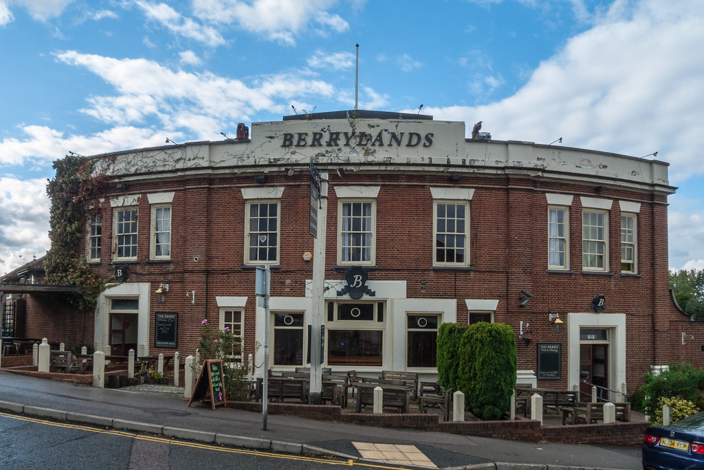
I woke up to a fight morning, but the weather people were promising sunny weather, so I would keep the momentum going, Hatton Cross to Uxbridge which is 11 miles. By the time I had parked up in Uxbridge the air was still chilly but blue sky was starting to be visible through the now low clouds.

I missed a 222 but they run every 7 minutes so it was not long before another one came along. I decided to shave 10 minutes off the loop by skipping half a mile of the loop to save having to change busses. When I got off the bus I must have got my map up the wrong way because I crossed the road and walked to where it crosses the LOOP. At the zebra crossing I noticed a lady and two boys, she was carrying the same print out I had in my back pocket for the sections I was doing that day, I wished them luck with it but i’m not sure they made the connection. They were however the first people I had seen who were without doubt doing the loop (or part of), other people I have seen may have been but without asking I will never know.

Tesla cockpit

Once on the path I crossed a park then I had to cross a road at the end of a housing estate, the rubbish at the side on the bend in the road was awful the worst I had seen so far on the walk, it was on Cranford lane. I followed the river for a mile or two and came across a church which was almost smothered by the M40 which I passed under and about 500 metres further on the path turned left at 90 degrees and follows the Grand Union Canal for a couple of miles as it edges through the industrial area of Hayes.

I left the canal and the path took me through a business park then across the edge of Stockley Park golf club across a dual carriage way and across Stockley park itself. Eventually dropping me out on a business park on the edge of Yiewsley. I decided a coffee was in order so my eyes were on alert. I spotted a Tesla showroom and ditched the coffee idea for a look at the cars inside.

Tesla can in the show room

The sales man was a friendly chap even when I explained that I was far from being a customer. He answered all my questions and we chatted about how Elon Musk was really just a battery manufacturer. he invited me to have a sit in the cars and encouraged me to play with the massive touch screen that they have in the centre console. Finally he offered to get me a coffee from the fancy machine they had, thus saving me a couple of quid. I thanked him and set off again and was soon dumped back on the canal towpath, where I spotted my second lift boot converted to a canal boat with living accommodation, I had previously seen one on the Thames river bank.

Red autumn leaves and green pond weed

I was feeling a bit peckish so when I passed a large Tesco on the side of the canal I popped in and got a sandwich and a bottle of water, then where the path takes a left at Packet Boat Marina near Little Britain I stopped at a handy bench and consumed them. Soon after the path leaves the canal and head north following the Colne river leaving the Slough arm of the Grand Union to go West. I carried on the Grand Union for a while before realising I had missed the turn, however I was able to se two instances where the canal was bridged over a couple of rivers.

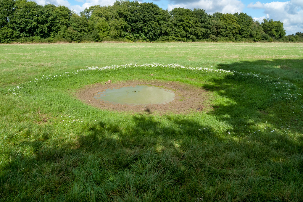
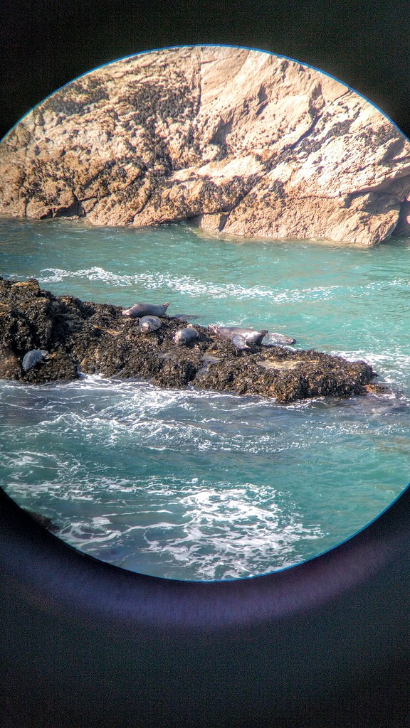
The Colne river passes through an area with lakes and I saw plenty of wild life and not many people. I saw both a Heron and Little Egret both in a tree which is not usual to see before roosting time in the evening. The path follows the river round the industrial estate on the west side of Uxbridge and ten joins the Grand Union again for the last couple of miles. I did not take the first opportunity to get back to the car but took the next left so that I reduced the length of the next section to Moor Park. It looks like it will be mainly on the Grand Union.

London Loop – Kingston Upon Thames to Hatton Cross

Deer rut in Bushey Park

This section was going to be a strange one, from Kingston ending up at Hatton Cross tube station, and thankfully a shortish one, 8.5 miles, after the previous days 15 miler. It would be the first time I would not use my Railcard as I would be using the car and a bus.  I would be doing an official section so it was well documented.

I set off at a reasonable the and set the satnav for the NCP car park at the Hatton Cross station. It took me round the M25 and M4 things went a bit wrong after that.  The satnav said I had arrived but it was nowhere to be seen, I carried on a bit but then had to stop to consult Google maps, which soon got me to outside the station but the on a road with no access to the far park, it was on the A30, so I had to go 1 mile back and forth to get to the entrance.

The Shot Tower Crane Valley

Luckily the bus was due and I was soon en route to Kingston, as we got closer things became familiar as places I had passed when doing the Thames Path. The bus stop was near the bridge on the side I had finished but it did mean I would miss a few hundred yards of  the Loop. Once across the river I entered Bushey park which was very popular, with loads of people about. I could not resist a stop at the woodland garden coffee establishment for a coffee and a piece of cake, I had to take the day easy, after all, because of my sore foot.

The deer in the park were in full rut and far more approachable than the ones in Ashridge. There were plenty of photographers and long lenses about. The path keeps mainly to the wooded and lakes areas. It was a real pleasure to walk through, alas it came to an end and the path spent a while on roads and in housing estate until it enters Crane Park, and follows the river Crane for a mile and a bit.

BA Hangar heathrow

Halfway through the park there is a shot tower which has been renovated and is now a visitor centre for the London Wildlife Trust, unfortunately it was closed, I bet the view is good from the top. According to the web “Once the site of the Hounslow Gunpowder Mills, Crane Park Island is a beautiful reserve where you could be lucky enough to spot a majestic kingfisher or the threatened water vole.

It is a mosaic of woodland, scrub and reedbed, which due to careful management provides a home for the increasingly scarce water vole.

The island welcomes visitors throughout the year and has good facilities for people with disabilities. School children on specially organised visits can investigate the rich aquatic life in the shallow stretches of the Crane.

NCP car pak under the flight path at Hatton Cross

The old Shot Tower was opened as a visitor centre in 2004. It is open to the public every Sunday afternoon between 1.30pm and 4.30pm and for special events. Call 07702 669 888 for details. It was 13:20 so I hung around for 10 minutes, until a lady on a bicycle turned up and opned up shop. I asked if it was worth climbing the stairs to the top, and convinced me it was. Given I had walked quite a way by then ot was quite some effort and a bit of a disappoint men as the view was not quite over the tree tops.

Next came Hounslow Heath which is a large expanse of heath land and I spotted quite a lot of birds about. It is directly under the Heathrow flight path so it can be a bit noisy. I got my scanner out and listened to the air traffic controllers and ground staff going about their jobs. I passed through a wood called Donkey Wood and joined a river for the rest of the walk, it was pretty uninspiring as it looked polluted and ran down the back of houses and industrial buildings. I hit a dual carraige way and had to walk about 1km along the pavement to get to Hatton Cross station before I could tick that sections off.

London Loop – South Coulsdon to Kingston upon Thames

Sir Francis Crick Institute

A bit of a milestone thus section as I was about to hit the Thames again, so that is kind of halfway. It was a going to be a tough one because the distance is more than 12 miles, but I figured if I start out early I would have plenty of scope for rests. I was up at 7 and resisted the urge to switch my PC on and be distracted by the internet, I was aiming for the 08:11 but when I got to the station I was in good time for the 08:01, which was slower but got to Euston 4 minutes earlier.

I expected to use the Victoria line but Google maps suggested an alternative, using the Thames link from St Pancras, which meant a 5 minute walk. It gave me an opportunity for another London terminus tick and a chance to see  the Sir Francis Crick Institute building. I noted that the cafeteria had a few two people tables but mainly a few long tables with chairs down each side. I guess that it means that people will mix more because they end up sitting next to people. In my work cafeteria all the tables are round and you end up with the same people on the tables each day. With a long table you still get the groups but they are sat next to other groups rather than being isolated. I quickly took some pano shots as the building is tall and hard to get into one shot.

Suburbia seen from the London Loop path

At the St Pancras I quickly found the right platform and my timing was perfect, the train pulled away about 30 seconds after I boarded. The Thames link crosses the river close to Tate Modern in fact the station is over the river and you get a great view of the gallery, The Shard and The City buildings named after thing you find normally in a kitchen. The train went as slow as it did last week and after crossing the Thames soon joined the same set of rails. I theorised that it always went slow but would speed up when it got away from all the junctions and was speeding through the countryside to Brighton.

The route out of Coulsdon was quite well signposted and although it starts off in the town soon you are in the countryside. At the edge of Coulsdon I came across a funeral directors called  W A Truelove & Son Ltd which I thought was an interesting name. Close the Oak Park I cheated a bit, missing off a dog leg to avoid a couple of hundred yards of road, and I thought I had missed the Mayfield lavender. I had but not only was the place closed but the lavender was obviously in hibernation with hardly a purple shade evident in the field. There was however a red phone box and a wooden gazebo, which I guess photographers use as props. The path I took did run along one edge of the field.

Spaceship building

I rejoined the path at a road crossing and entered Oak Park, it started to rain so I took the opportunity for a rest and a coffee in the café, in the hope that the rain would stop when I ventured outside again. The BBC had promised rain but when I checked the latest predictions it was more optimistic. I had to cross a Golf course with dual carriageway between first and second 9 which must be a pain for the players. The LOOP is not well sign posted across the course, and I clearly looked lost too, as a cuple of golfers asked me if I was, not that they could tell me where the path was!

Banstead Down is an SSSI and I saw my third Jay of the day, the first one in a front garden. I also noticed holes with acorns in the bottom evidence of squirrels and jays preparing for winter. The Golf course dumped me into a housing estate, which looked quite posh. Then I noticed that I was in the borough of Epsom and Ewell, and a sign informed me that it was twinned with Chantilly France.

Across Warren Farm Woodland Trust I had to keep to the paths as there were of dog walkers and shit when you are off the paths. I got to Ewell Castle School.ans then into the centre of the town it was lunchtime and the first good establishment I came across was an Italian, it was empty which was a bit worrying, but it looked good and they has spaghetti di mare on the menu. I needn’t have worried as no sooner as I has orders more customers started to arrive. They served bread in a basket which was a nice touch, I ordered a Perrier to go with my lunch which turned out to be a 75cl, I was not carrying water so managed to drink it all. The spaghetti was excellent, and I lingered a while to finish off he water and avoid a stitch when I did get back on the Loop. As I left the restaurant the sun was shinning.

Berrylands interesting building

I walked though Bourne Hall which now has an interesting spaceship of a building housing a museum of local history. A sign told me I had 7 and a quarter miles to Kingston. I passed East Ewell station and realised I was off the path so I ended up taking a longer route and missing a kilometre of the path, but I was soon back in n the Loop path.

Next up was Hogsmill NR and Jays number 5 and 6. The path follows the very long reserve for quite a few miles. At one point the path went along a road rather than keeping to the rivers edge, seemed like a pointless detour so I kept to the river. Before the detour I stopped at a Toby Inn for a lemonade and to rest my feet.

Crossed dual carriageway with a double back to use a subway, then into Elm Wood meadows. The path continues to follow the river Hogsmill until you finally hit a housings estate then you go under a railway, but not before spotting 9 Parakeets in a flock. I passed Hogsmill sewage treatment which smells of piss, so I did not hang around. Next up was Surbiton cemetery and some near by stone masons. The outskirts of Kingston came swiftly after and my feet had had enough, 15 miles seems to be my upper limit. I weaved my way up Kingston high street dodging the shoppers, and found the station. I has a painful run to get to platform 3 for the 16:18 to Waterloo, it saves me waiting 15 minutes for the next train.

I got off at Vauxhall and got the Victoria line to Euston then made the mistake of thinking I could get a bottle of water from M&S (no queue at the checkout) and get to platform 8, I missed the train by seconds, so had to get one 20 minutes later. As it happens the second one almost caught up with the first one, so little re was lost. All in all a good day where I managed 15 miles, which although probably a bit too far is good to know I can.


London Loop – Croydon to Coulsdon

London loop view near Croydon

Holidays and other stuff had got in the way of London Loop sections, although it was a Sunday the weather looked good so I got up early and headed to Berkhamsted, to do the section from Croydon to Coulsdon.

On Saturday I did a trip to Banbury to have a look at the North Signal box, which was to be demolished on Monday. I invited my dad and Helen’s dad and they both enjoyed the opportunity, to have a go at pulling the leavers, something they had never got to do whilst young train spotters.

Strange pond with daisy circle

It was cold and overcast when I got to the station, but on the journey to Euston on the 08:40 the clouds started to clear. The Victoria line took me to Victoria station where I had time to get a coffee before the slightly delayed 08:32 to Brighton could take me to East Croydon. I’m not sure if it was because the train was delayed or not but they announced that it was not stopping at some of the scheduled stations, and then proceeded to stop many times between stations. Eventually slightly later than advertised the train got to East Croydon and I alighted.

It took a while to find the tram stop as I had exited from the station via a side entrance and the tram stops are at the main one. The trams have quite an acceleration on them and quickly get up to speed, there should be more adoption of them in my opinion. I got off at the Combe Lane stop and quickly found the LOOP path.

The path is again surprisingly rural sticking to woods, meadows and down land, I eventually got to Selsdon where a parade of shops was a great place to get some lunch, as I was travelling light with no camera bag. I grabbed an egg sandwich Snickers, and a bottle of water at the  cooperative, crossing back over the road I noticed a .non-branded fried chicken takeaway, and so I popped in GR some chips to go with my lunch. The menu pictures showed MacDonald style chips so I ordered a large portion. When the portion was handed over it was a large box full of chips the type of they use to hold the chicken meals they sold. I tried my best but could not finish them, and I had to save my egg sandwich for later. I later lost the Snickers from a hole in the carrier bag I was using.

The path was really against the grain of the landscape constantly crossing hills and valleys rather than running along the valleys. It was as if I was in the Chilterns with chalk downs and clifss evident. A very just be landscape looking really great in the autumn sun.

Mini observatory on the London Loop

I passed through quite a few City of London Corporation park lands, and a could of National Trust parcels of land. Henley comments n also has an airfield in the middle of of it but there was no vantage point from the path nor any evidence of activity. It was however still owned by the ministry of defence.

The final mikes after Coulsdon Common involved walking through or past some strange names such as Happy Valley, Devilsden woods and For thing Downs which was about mile and a half of hill with great views all around. Just before Happy Valley I came across a couple with several dogs including two Labradors one of the came bounding towards me followed bt the second one which was a bit bigger, and proceeded to body slam me against the inside of my right knee, almost taking me out out in the process. I was lost for words at the time, the bloke looked concerned but the woman just said “Labradors are boisterous aren’t they?”, I just carried on walking with a bit of a limp. Had I been a smaller person or someone who was frail they definitely would have floored the person. The last mile was down hill and got me to Coulsdon South rail station, where I had a half hour wait for a train to London Bridge, which stopped first at East Croydon.

I has a rush from the mainline station, with only minutes to spare to get to the underground then to the right platform at Euston for the fast train to Berkhamsted. I had time to grab the Snickers I owed myself and a bottle of water before running to the platform to get on the train. There were not many spare seats but I managed to find a single spare seat.

All in all a a good day out with lovely landscapes and beautiful skies. Quite a long walk at over 12 miles for the day.


St Agnes – Holywell and back via Pentile Point

Walk from Holywell via Crantock and Poly Joke beach

Last day of the holiday in Cornwall and although it is an even day we went for a walk, as we had been in training all week. The plan was to park up at the Holywell car park then walk in land to West Pentile where this is pub called the Bowgie Inn, then walk back to Holywell beach via the coastal path.

Once parked up at the National Trust car park, free for members and adding to the savings to offset against the membership fee, we walked in land flowing a river and passing through a very extensive camping and caravan park. The we did an acute turning and headed up a hill that once at the top gave a great view of the area with the sea visible of three sides of the square so to speak.

Seals on a rock

We descended down from the peak and crossed a road and then the path went through a caravan park which was closed for the season, it had many activities including a fishing lake, and the notice boards promised entertainers, singers and comedians, including once called Jim Gutrench. A gold course followed with the path nicely protected by Cornish walls/mounds. Eventually we descended down into a valley where there was a car park for a beach we would pass later. The way out of the valley was confusing but we eventually hit the right path which lead to a road or track again up the hill till we got to West Pentire, the a the Bowgie Inn beckoned, and what a great find it was.

The Bowgie Inn is in a small village but as we approached we noticed it was quite busy and lots of outside seating, it was clear why when we got there. The view of Crantock Bay is fantastic and the light we we arrived was almost perfect. We stopped for a coffee and a bag of crisps and I took a time lapse sequence. We lingered for a while watching the surfers in the distance the breaks were quite a way out so a couple of them were getting really long run ins.

The path crosses the bottom of the pub garden, which was handy. The next few miles were spectacular, and the photo opportunities many. Eventually we came across Pentire beach which we had passed earlier, and found a spot to have our sandwiches, it was idyllic and the perfect spot to share lunch on our last full day in Cornwall. The sea was a deep blue and breaking in parallel waves onto the beach, and the sky was blue with the occasional passing fluffy cloud.

Walk from Holywell via Crantock and Poly Joke beach

The walk back to Holywell bay was quite eventful, first Helen spotted some seals on a rock just off the coast. We watched them for a while and the total count at one point was 12, far out stripping our best tally of the week of two.  A little further on I went to look at whatever the couple were looking at over the cliff it turned out to be a sheep part way down the cliff. It was standing still looking like it could not decide which way to get out, I was not about to try and rescue it because the way out was fairly obvious.

The last mile and a half were down hill and then on the beach. It was tedious walking across the dry sand at the top until we found that the damp sand by the stream that runs down the beach was much easier walking. We were back at the hut at the same time as the owners who had been to The Eden Project as a treat for their wedding anniversary. We had a chat then retired to the hut to tidy up and pack so we could get an early start. We had fish and chips for tea from the chippy opposite the pub, my hake was very  nice and the chips were double cooked so very crispy.

St Agnes – Porthtowan back to to the pub

Walk from Holywell via Crantock and Poly Joke beach

We had a plan to walk from Porthtowan back to the pub for a half, but the buses were not convenient either a early start or a late start. Then I remember that there is a museum in St Agnes and the bus stop was near by. So the plan emerged, we would walk up to the museum for the 10:30 opening time then we would have an hour before the 11:30 bus. That mean a leisurely start, we left the house at 10:00.

We walked up through the village which thus far we had only seen from the car. There is the St Agnes Hotel signs that the place was once and important town. Then we cam across the Railway Inn yet more evidence that the place was important. The museum would reveal all.

Walk from Holywell via Crantock and Poly Joke beach

We got to the museum just as it opened and a friendly man welcomed us in. The museum is very interesting and very well done. It gives you a great insight into the history of the area right up to current days with a cabinet showing a multi-generation of doctors who have served in the village. We were early for the bus so I bought a paper and we sat at the bust stop and caught up with the news.

Walk through village hill There were quite a few people at the bus stop but when the 315 arrived we were the only ones to get on. I guess the rest were waiting for the 87 to Newquay or Truro. The bus takes a rurtal route and takes a least one detour to visit villages. Eventually we were dropped off near the beach at Porthtowan. We headed straight for the coat path and the hard slog of getting out of the river valley. Just before Porthchapel we came across a bench with a view where we had our sandwiches and did some sea watching. Helen spotted something which we took a while to figure out what it was, but eventually we realised that it was a Sunfish a rare but increasingly more common sighting in Cornwall.

Walk from Holywell via Crantock and Poly Joke beach

It was a pretty short walk down to Porthchapel where we had a coffee at the National Trust coffee shack. We headed the beach to enjoy our beverages and the view. I took a timelapse set. We then headed on again up the steep hill towards St Agnes. On out left was the beacomn the man in the museum had explained about and Helen was interested in because of the arrow heads found there and on display, however after the slog up the coast path Heln declined the offer to walk to the top of the beacon.

Near the coat watch car park there the local radio control club were flying gliders, the steady breeze from the sea made it a great location, however I guess mistakes can be costly with the sea and the cliffs. As we left the coat watch I noticed a man on the floor ahead, in my binoculars they were not moving but then he started to get up slowly. I rushed ahead and check that he was OK, he was I think he was just embarassed at having fallen over.

The final mile or two was on familiar territory with great views as the sun dipped lower. Back in the village we used the excuse to book a table to eat to buy a sneaky half. We had had a lovely day in perfect weather.

St Agnes – Walk Holywell to St Agnes

Walk from Holywell via Crantock and Poly Joke beach

Day three an odd day so it is a walk day, we had a plan to get a bus to Holywell then walk back to St Agnes, however the best laid plans do not always pan out. We were up early and in time to walk up to the bus stop for the 09:32 bus to Newquay. We set out earlier than necessary according to Google maps, I did that thing I have done many times. When you go for the public transport option in maps it includes the time to walk to the bus stop, I have a habit of taking the time as the bus departure not the start walking time.

Walk from Holywell via Crantock and Poly Joke beach

We were very early for the bus so had a 25 minute wait, but it did turn up which is a good start. We needed to stay on the bus for 22 stops and get off at Cubert Crossroads which turned out to be in the middle of nowhere. It was not obvious where the bus stop was but we decided that walking towards a lay by in the direction of Holywell was the best bet, and it did turn out to be a bus stop. We were a bit late for the bus so we gave it 25 minutes before I convinced Helen we should give up on the bus and walk cross country Perranporth and miss out Holywell. We walked a few hundred yards down the road and lo and behold the bus drove past. Helen was not amused in fact she was hopping mad and I was somehow partly to blame (as logistics manager for the walk). Helen soo cheered up when we spotted some Goldcrest in a tree by the road.

The walk to Perranporth was mainly on a road but not much traffic and it made a change to be in the Cornish countryside rather than a cliff path. We turned towards the sea at the Perranporth golf club and eventually hit the beach and headed towards the town. Helen decided she had walked far enough so I waited for the next bus back to St Agnes with her then headed off up the hill and back onto the coast path, which was a bit of a slog.

Walk from Holywell via Crantock and Poly Joke beach

I stopped after half and hour and enjoyed my sandwiches on a sheltered bench with a view. The path then headed even higher and passed some fairly significant mine sites and some very interesting geology, wtih layers of dark rock in a mainly lighter quartz or silica rock. There was also lots of mine spoil so much so in fact they appear to have dug a path through it for the coastal path. The route took me around the back of the Perranporth airport where a plane kept taking off and landing not sure if it was flight lessons or flight tours.

Eventually I came to the path that descends steeply into Trevellas Cove, where a sign suggest no walking around the beach to St Agnes. I threw caution to the wind as the tide was far out. It was a bit tedious stepping from rock to rock but it saved another massive up section then another down to get to St Agnes. Helen was wandering on the beach when I got there looking for the seal she had spotted the evening before, it seemed to like looking at the surfers from a safe distance. We had a regular half, well in my case a pint as I had done 10 miles of coastal path, then we headed back to the hut.

St Agnes – Trelissick and the Roseland Peninsula

Portscatho panorama

Day four even number meant a relaxed non: walking day, our initial aim was Trelissick and National Trust property with extensive gardens, then we would see whare the wins took us. We left the house at 10:00 and arrives at Trelissick at 10:30 perfect timing of the house opening times.

We first headed to the house and had a look around, the contents were quite bear and I overheard some mentioning that all of all the content was from when the hose contents were auctioned off. Then we headed to the orchard garden area where there are lots of exotic trees. By then it was coffee and cake time a fruit slice went down nicely.Finally we walked out to the end of the Peninsula with fantastic views of the Fal estuary.

St Mawes harbour

Trelissick is near King Harry’s ferry to the Roseland Peninsula we decided to give it a go and take a look at the isolated finger of land. The ferry saves a 27 mile round trip. To get on the ferry we left Trelissick and turned right, on to a road that steeply descends down to the river level. We did not need to wait to take the switch back and drive onto the ferry, infact we were the penultimate car on board. The cross does not take long, less than 5 minutes I would say. We headed first down to St Mawes the biggest population center on the peninsula.

We ignored the signs to parking instead choosing the signs to the castle which is an English Heritage property. We did not stop at the castle but carried on round to the sea front and were happy to find a space in the harbour car park. We had a sandwich  in one of the seafront establishments, my crab sandwich was generously filled, bit no cheap at £9.95.

Portscatho limpets

Next we headed to St Antony the end of the less popular peninsula, where there is a gun battery from the war which we found out includes a bird hide. We walked out to the bird hide via a walled path, presumably to protect the soldiers. From the hide we the view was of a cliff opposite, which  we thought strange but then we realised that we were probably looking for a Peregrine Falcon, and we did manager to see it dive after prey. After a look around what was left of the gun battery then we drove back up a different road up the peninsula to a village called Portscatho which has a history of artists living there/ It was a quiet place and we had a walk around and a look at the beach.

It was time to head back to the ferry where I took to the opportunity to get a couple of timelapse sequences. The queue for the ferry was pretty short as one was half way across when we arrived. Truro traffic was busy, we went to Waitrose for some salad for tea, and got back to the hut just oafter 18:00 with plenty of time before Back Off started.

St Agnes – Trerice NT and metal detecting

Sea view near St Agnes

A high was pushing away a bank of rain overnight but it had not done its job by morning. We decided a more less energetic day was in order, so we would start at a National Trust property called Trerice less that 30 minutes drive. It turned out to be an interesting drive as the satnav insisted on a single track lane for a significant part of the journey.

We arrive just before the house opened which was perfect timing. The house has quite old original bit is a very good state of maintenance. Quite a small house but interesting stuff within. I had to sample the famous lemon meringue pie in the café which went down nicely with an americano. We killed time a little writing postcards, to get that holiday task out of the way and to give the weather front a bit more time to move along.

Portscatho view

We had a look around Newquay and parked up at Fistal beach to see if there were any surfers out, it was raining and wind swept there were not a lot of surfers out. Then we headed to Crantock beach stopping off at the village shop for some metal detector batteries, then parked up at the beach and headed out with the metal detector.

It took a while to get our hand back in but we did eventually find some stuff including a tent peg, a couple of screws, some tin cans and a few bottle tops, we are not going to get rich. Next we headed to Truro to get some provisions, from the Cornish shop at Waitrose this time beetroot salad and a mushroom salad. Back at the hut we headed down to watch the surfers taking advantage of the last of the summer, then had a half at the pub.

St Agnes – Walk to Chapel Porth and back

Stuff at St Agnes harbour

Our first day on holiday so we thought we would be better to go easy to test our legs, although I had been walking a lot this year most of the walks had been flat, the Cornish coastal path is far from that. Our plan was to walk to Chapel Porth and back trying to make a circular route.

We started by walking down the road to the beach but took a left at The Driftwood Spar freehouse. The road was very steep and we eventually came to a twee little mobile home park in which the homes were all like large sheds or chalets. We joined a foot path there and then a track. There is quite a lot of activity at the top above the village of St Agnes, there is a rugby and foot pitch probably because it is the nearest flat piece of land. There was also a lot of building work going on with some new houses being built and others being renovated.

Sea view near St Agnes

We find that the foot paths in Cornwall are not that well sign posted and we eventually could not find the path we wanted so we ended up walking along a road but found a convenient bench with a view for a rest. Whilst sat there we saw lots of modern Jaguars drive past the turned towards the sea and the car park near the coast watch hut.

We headed in land too but took a footpath that took us west and closer to the sea. The path became quite steep at loose under foot at one ppoint but we made it to the bottom of the valley where there was a National Trust car park, WC and importantly a small cafe shack where we got a drink and a flapjack to share. We consumed out beverages down on a large rock on the edge of the beach, then we went for a wander to look at the rock pools.

Sea view near St Agnes

We headed back keeping to the offical coast path all the way, it was steep exiting the valley but we took a rest halfway up at a tin mine building with a bench next to it. The sandwiches we had made earlier went down a treat, and a view over the sea to go with it.

The final stretch down towards St Agnes was tough on the knees which were out of practice for hill, note to self do the Ridgeway path with all it’s ups and downs to get your knees in trim. Just on the edge of St Agnes we came across a group of 4 just about to launch a small drone with a very sophisticated controller, the strap told me it was Parrot gear. I sat and watched it being lauched then I looked over the bay, next thing I know I heard the bloke flying it saying “It has never done that before” as they all looked over the wall then climbed to look down the cliff. They had lost the drone some how, I did a good job not laughing as I left hem to it and headed down into the village.

Flower closeup

We stopped at the pub and had a swift half, before heading back to the hut, where I polished off one of the scones that had be on the hut when we arrived, the clotted cream from the fridge went nicely on top followed by some strawberry jam. We lounged about for a bit before heading back to the pub for some more beer and something to eat.

I had a pint and the baked skate wing special which was very nice. We shared are table with another couple who were interested in my map app. After eating we went to look at the sea and there was another man flying a drone, however this one came back to him.