The taxi arrived on time to pick me up from the rose revived public house who had kindly let me park my car in the car park for the day. The taxi journey took about 20 to 25 minutes and dtrop me off at the national trust car park near Buscot Weir.
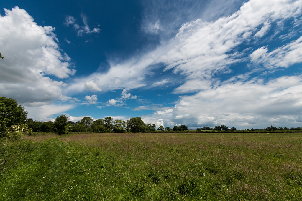
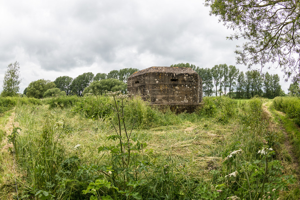
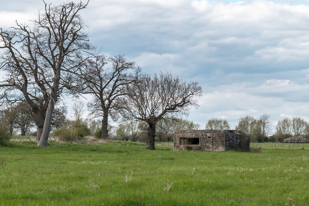
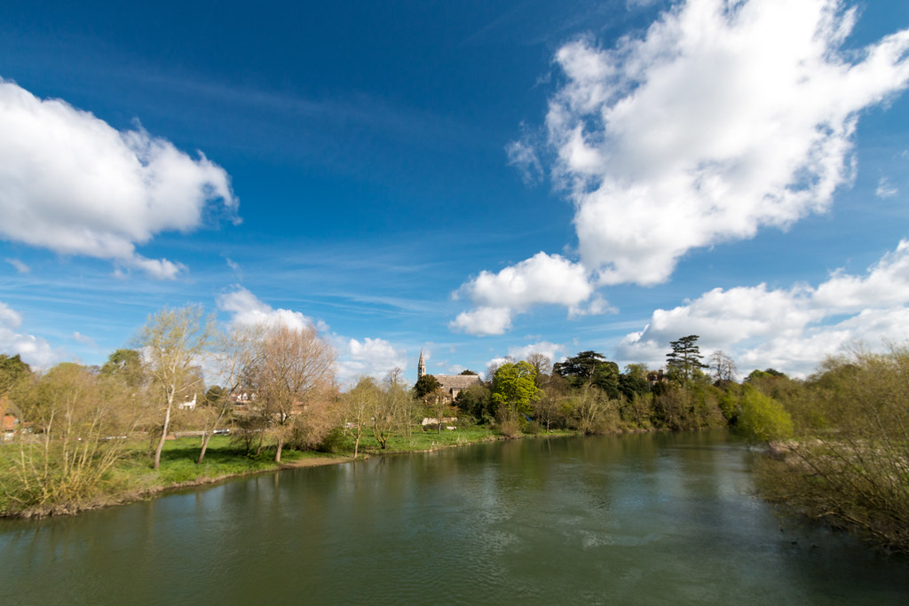
The river bends and twists quite a lot up at this end but it’s an approximately 15 to 20m wide most of the time. I saw a few pill boxes as I started out on the walk and I made a note to try and find out why there are so many this side of the country.
The weather was sunny and promised to be in 21 degrees during the heat of the day so I erred on the side of caution taking less clothing than I actually needed early in the morning. There was still a bit of chill in the air but the sun was warming me up.
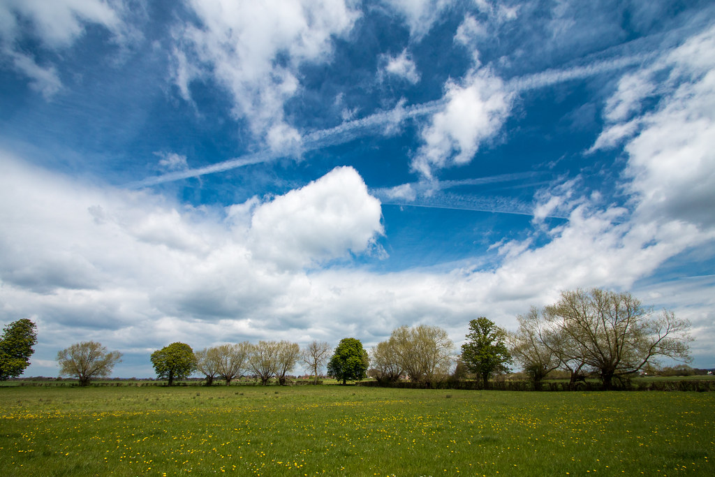
The day’s walk would be 15 miles and would include two pubs en route and one at the end. as I approached the first pub Ye Olde Swan I noticed in the field what I thought might be hares ears but on closer inspection they turned out to be clumps of snakehead fritillaries. I pulled in at the pub for a glass of orange juice and soda water and polished off a couple of packets of crisps. Over the river and next to the thames path were a bunch of wigwams which seems to be very well equipped including log burners inside.
Wildlife was out in force on the next stretch to pub number two I could hear Curlews around calling and surprisingly I heard a ruddy duck and then a bit further on her the cuckoo which I did managed to track down and got great views of. I thought I could also hear warblers in some of the reeds and rushes.
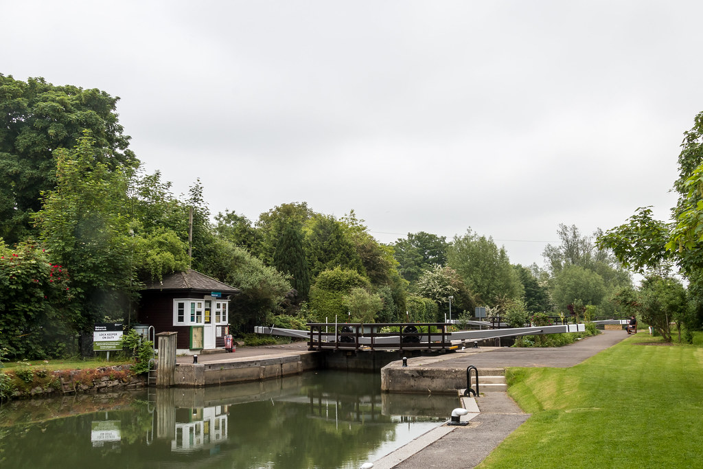
When I reached the Trout Inn at Radcot I continued on I wasn’t ready to stop, I figured I would stop somewhere in the Chimney nature reserve. I got close up views of another Cuckoo about halfway through the Nature reserve. I eventually stopped at Shifford lock, where the lock keeper roped me into holding the painter of a barge with only one person onboard. I rested after the exertion and eat my sandwiches, taking my time because I had made good progress.
I got to the Rose Revived about 1600, but did not stop for a drink, I headed straight back.
This next step of the thames path with prove a transport challenge. The number of buses between Buscot and Cricklade are pretty few and require a change and take about 2 hours . My solution was to order a taxi life is to short to worry about things like that.
I had an early start at 6 left the house at just after 7 that got me to Buscot village at about 8:30. It took me 10 minutes to get sorted get my boots on and by the time I had walked to the village shop and the taxi arrived more less as I got there. Perfect timing!
The taxi dropped me off at the centre of Cricklade, in fact, exactly where I am parked the car the previous week so I didn’t miss a single foot step of the path. The river meanders quite a lot at this stage of the 10th and so the path is not no direct so although I would be walking 13 miles, as the crow flies it was considerably shorter.
The weather was 5 degrees so freezing I set off at a fairly good pace to get the blood circulating and warm me up. By about 10:30 the sun was starting to show through which made a big difference.
I passed through Castle Eaton which I remember from the first time I walked the Thames. The Jehovah witnesses were knocking on doors as I walked through the village. I avoided eye contact as I was on a mission to get some miles done. I did find time to look at the church of St Mary’s which is 8th Century.
Towards Kempsford the path goes along a main road for about 2km which is not fun. I chose to leave the path and take a longer route via the edge or RAF Fairford. It was a good decision as I witnessed 3 B52s taking off. When I got to the perimeter fence there were lots of, mainly men, on step ladders taking pictures.
The road into Welford, then took me into a private housing scheme around a gravel pit. The houses looked very modern and had open plan living all with a water view, and all identical.
At Lechlade i stopped for a coffee at Lynwood & Co they do a great coffee and great pistachio coconut and carrot cake. There were only a few miles left to Buscot Weir where the days journey finished.
I enjoyed walking the Thames path a couple of years ago and decided that I would walk it again this year. The weatherman was promising good weather for Saturday and Helen was away so it seemed like the right day to start. I was not wrong.
Thams path day 1 Cirencester to Cricklade
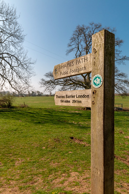
The Thames Path is a National Trail following the River Thames from its source near Kemble in Gloucestershire to the Thames Barrier at Charlton, south east London. It is about 184 miles (296 km) long. A path was first proposed in 1948 but it only opened in 1996.
The Thames Path’s entire length can be walked, and a few parts can be cycled. Some parts of the Thames Path, particularly west of Oxford, are subject to flooding during the winter. The river is also tidal downstream from Teddington Lock and parts of the path may be under water if there is a particularly high tide, although the Thames Barrier protects London from catastrophic flooding.
The Thames Path uses the river towpath between Inglesham and Putney and available path elsewhere. Historically, towpath traffic crossed the river using many ferries. but crossings in these places do not all exist now and some diversion from the towpath is necessary.
The far end of the Thames is 1:40 drive from home, so I managed to get an early night and left the house at 05:45. Unfortunately I just missed the 07:30 bus from Cricklade, where I parked the car, to Cirencester. I then had to wait till 08:12 which was the one I had planned to get. It was cold at the bus stop. Google maps was tellin me that there was a 51a bus at 08:12 but the notice on the bus stop said otherwise. I toyed with Uber but then ended up downloading the StageCoach app, which confirmed the 08:12 was a thing.
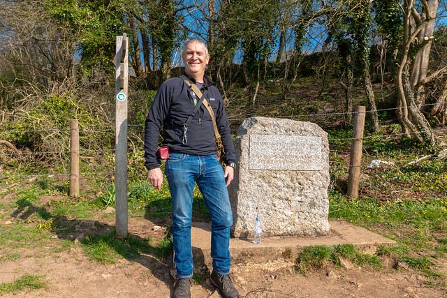
The bus sort of followed the route would be walking, it was quite foggy in places but the sun was out and burning it away pretty quickly. I got off the bus at Chesterton Cemetery then walked through the grounds of the Royal Agricultural College where there was lots of jogging going on. There was not much jogging happening when I was at college! I soon left the grounds and into the countryside. There were a few small hills to cross, the only ones of the day, before I got to the source of the Thames. I had been up for 4 and walking for one hours by that time, so I sat on the rock that denotes the source, ate my sandwiches cheese pickle sandwiches and regretted not having a flask of coffee with me.
The monument
A couple arrived and we got talking one of them was doing the last stretch, but in the wrong direction. They kindly took my picture while I stood in front of the stone monument and sign point past the source it self, a pile of rocks. There was no water in sight. I headed off on my way just a tad to fast as it would result in blisters towards the end of the day. It is about a mile or so of walking before you get to a riverbed with water in it, but an friendly old boy walking his dog assured me that a month ago the field around were flooded.
The far end of the river is very clear, in the bright sun I could see the clak gravel bottom of bright green under water plants. I could see a swans head as it reached down in the the depths to graze on the weed. The path is very easy to follow just keep the river on one side and if crossed keep it on the other. For lunch I stopped at the White Hart in Ashton Keynes, where a pint of orange juice and soda water and a fish finger really hit the spot. They kindly refilled my water bottle.
Near the start of the Thames for real
I then entered the stretch that would take me through loads of gravel pits. I guess they are there from building the M40. From a walking point of view they are a bit tedious, I prefer meadows. Quite a few of them are private and some have houses or holiday house clones encircling them. I was not in the best of moods as that point because my quick pace had now resulted in blisters on both feet. I had had a similar thing happen a few times before, you would have thought I had learnt my lesson by now.
The last couple of miles took me back on to meadows again and my spirit rose gain. I stopped and took a timelapse with my new DJI Osmo Pocket camera. Then headed towards Cricklade where I grabbed a coffee and a cake before finding my car and heading home. It got home almost exactly 12 hours after I left a long day, but it was great to be back walking the Thames Path.
Although the previous week was a failed attempt to finish the path off, it did set me up for a 13 mile final day with easy transport options. On Friday I phoned The Thames Head pub and asked if it would be OK to park in their car park for the day, a kind lady said it would be fine and thank-you for asking. I got the impression that people park their without asking! The journey there was straight forward I was up early enough to avoid the traffic at the A40/A34 roadworks. I had some Cirencester taxi numbers to hand but decided I would drive through the town. In the market square there were plenty of taxi’s and I made a note of the company name and number. On the way out of town I stopped in a lay by and phoned up Phoenix Cabs and they gave me an estimate of £15-£20 to get from the pub to Cricklade my start for the day, took them up on the offer.
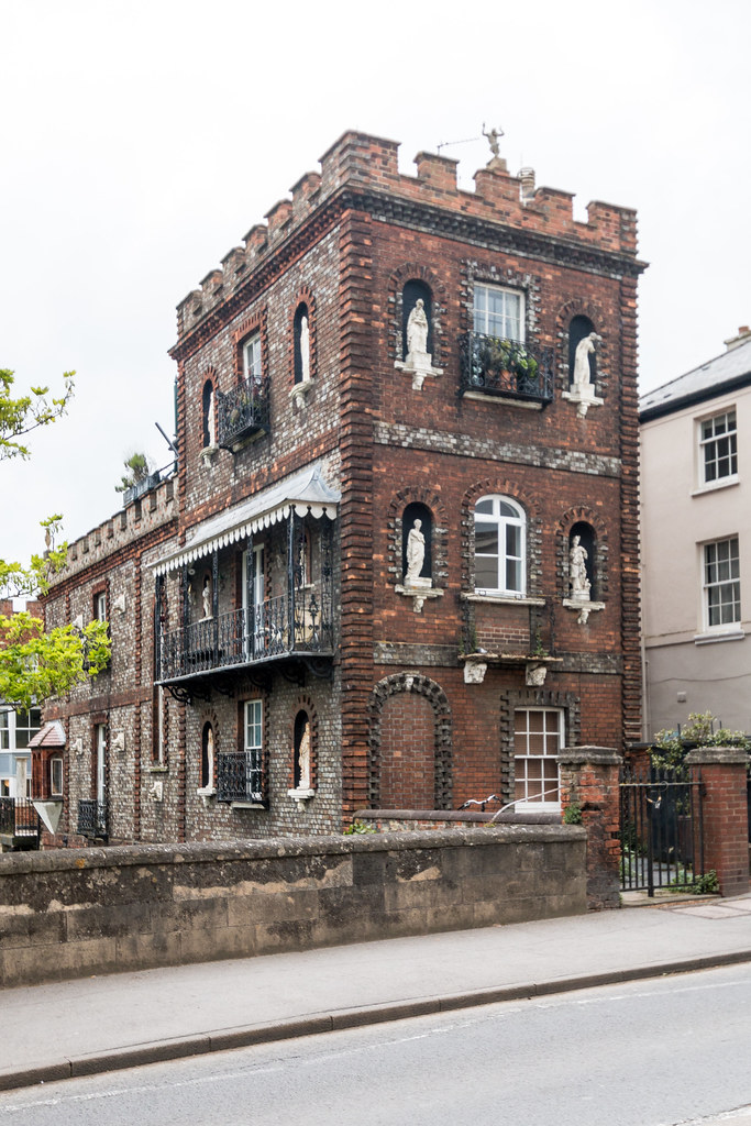
Cotswold Cottage on the Thames Path
I parked up at the pub and only had a 5 minute wait for the Taxi. The driver took me cross country and we crossed the Thames path a few times on the way, and passed through the Cotswold water park. By the time we arrived at Cricklade high street the meter said £34.40, but the driver kindly only charged me £25, a bit more than the estimate but I had saved my self quite a bit of messing around. It was not quite 10:00 one of the earliest starts I had had for some time.
I soon found the path again and was delighted to see a bullfinch fly from one bush to another. The weather was looking good although it was a bit humid and there was a risk of showers, but that meant blue skies and clouds perfect for photos. The path from Cricklade soon passes through loads of gravel pits now making up the Cotswold water park, this meant that compared to the previous few legs there were lots of people about. I passed through Elmlea meadow NR where there was lots of bird activity quite a few warblers and reed buntings as well as my surprisingly my first Kingfisher of the walk. The river was more of a brook and at times hard to see not only because the path does not always follows the rivers edge but also because it is quite overgrown. Once past the gravel pits I came to Summerford Keynes where I found a lovely bench for a rest and some lunch, of Bleu D’Affinois sandwiches, which went down a treat.
Field view on the Thames Path
The river got narrower and narrower, but then for a few miles it became wide and shallow with a chalk bed, and very clear. I had been slowly catching up with a young couple, but each time I stopped for photo’s they got ahead again. Following them was a mistake because they lead me to a river crossing that would have needed us to take off our boots and roll our trousers up above our knees. Luckily the missed turning was only 50 metres back, and I took the opportunity to skip off ahead while they consulted their map.
Helen’s dad had arranged to meet me to walk the final few miles and have a look at the source. He called me up and said he was at Parker’s Bridge just between Ewem and Kemble, I was only about 30 minutes away. I needed a rest by the time I found him. My left hip had been playing up a little bit earlier in the day but I had walked through it, but even so I took a couple of Paracetamol to take the edge off. I was very happy about the hips situation it means I should be able to up my mileage, ideally I would like to be able to do between 15 and 20 miles in a day. I noticed that the Volvo from passenger tyre was a bit flat and we agreed to check it out when we returned later.
Storm over field on the Thames Path
We set off for the final stretch of about 3 miles, the river was very over grown but at times it was clear in the woods, and you could see that the river bed was chalk and sometimes there were sections 6 feet deep and you could see the bottom, it was very clear. As we got towards the last A road crossing it looked like the rain showers I had avoided all day were about to dump on me. Sure enough as we got within a mile of the source it started to chuck it down, so the poncho came out for the final stretch.
The source itself is in a field full of cows just at the edge of a woods, and is a pile of stones, disappointingly there was no water trickling out. A couple of yards away are a couple of oak trees and a stone plinth marking the spot. We took a few photo’s then sheltered from the rain just inside the woods, but soon got bored and decided that we would have to brave the weather again. At the edge of the cow field we stopped tracking back the way we had come as there was a more direct route back to The Thames Head pub where I had left the car. We had a pint of summer ale and a packet of crisps then drover a back to Parker’s bridge to drop Helen’s dad off and check the tyre. It was very low on pressure so I used my pump to top it up and left the pump with the Volvo in case it was needed on the journey home.
The source of the river Thames
The drive back took longer than necessary because the A40/A34 interchange was busy, then I made a bad decision to go back via Thame rather than Bicester, so I hit more traffic on the Oxford ring road. I was home by 18:30 after picking up Helen.
I really enjoyed the Thames Path walk, for many reasons. It meant I knew what I was doing each free Saturday and made the most of my leisure time. I have lowered my resting heart rate from 78 down to 62. I have managed to keep up with all the podcasts I follow. Although it would have been nice to share the journey with someone it was also good to have some quality “me” time. I’m now looking for the next walk, the options are the Ridgeway, which will be a real logistical challenge, but a Facebook friend suggested the London Loop, which will be easy to do logistically and will have plenty of photography opportunities.
It was getting more and more time consuming getting to a starting point on the Thames because of the distance from home, I had only 30 miles to do so I took the opportunity to do it all in a weekend. Helen was busy on Friday night and Saturday night so I hooked a room at the Cirencester Travelodge for the Saturday night, the plan was to get 16 miles from Radcot to Circulate done on the Saturday then finish off on the Sunday.
I was not up quite as early as I would have ideally liked and then a false traffic alert on the satnav caused me to reroute, all conspired to get me to Cricklade later than I planned. The parking was free and the wait for the early bus was short, I was soon on my way to Swindon bus station. Interestingly the bus did a tour of the town before heading to Swindon and stopped at the bus stop opposite the one I got on at before heading to its advertised destination, which probably explains why it was early?
Overgrown Thames “Path”
Swindon has some very depressed areas and the bus seemed to pass through most of them, the bus station could also do with a bit of a spruce up. The next bus pulled into the station very soon after the first one terminated, the driver did not have any change so u got a five find note and a £1.40 voucher in return for my tenner. Whilst waiting for the bus to leave I contacted my Faringdon taxi company and arranged a taxi for 10 minutes after the bus arrived, this week they only wanted a tenner, I’m sure it was £20 the week before.
On the bus to Faringdon we passed through Shrivenham and just outside we looped into the entrance of a defence establishment that looked very secure with its razor wire topped fences around the golf course! At Faringdon the taxi was waiting for me so no time was wasted, just before 11 I was on the path walking.
The path was in long grass which had tilted over under the weight of the overnight rain this meant that it was easy to get tripped up my stepping on one end with one foot and trying to swing the other under the grass stems. The grass bring wet also meant damp trouser bottoms. The path was very quiet just the odd fisherman near the bridges, and canoeists and the odd pleasure craft on the river.
The Red Lion Castle Eaton
The BBC weather had promised dome sun but it was overcast a looked like threatening rain. It was good walking weather, and I was soon down to my base T-shirt layer. Just outside Lechlade I came across a fox wandering across a field adjacent to the path, which is the second one I had seen on the path. At Lechlade I stopped off for a sandwich and coffee for lunch in a cafe just just off the river.
There was a two mile stretch which was on an A road and one map I had recommended getting a taxi, so who am I to argue. After finishing my sandwiches I walked into town to find one. I also needed to find some paracetamol as my hips were complaining, probably because it had been two weeks since the last walk, I was out of practice.
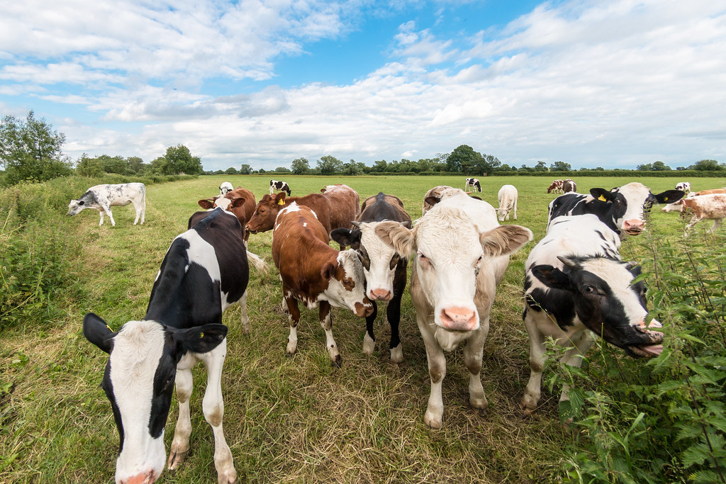
Friendly cows on the Thames
There was no taxi to be found but a very kind gentleman buying the Telegraph in the Londis, with a posh voice asked if I was going to Buford, which was a nice gesture, so I hit the road and braved the two mikes of A road, which it turned out has a good verge with a sort of path on it. I was glad to get back to the countryside and away from the traffic noise, even if the paracetamol wax having little effect, the pain was bearable I would just gave to break a bit more often, walk a bit slower, and bear it. Mental note to self start walking to work to sort that one out.
The path is away from the Thames for quite a distance until you get to Castle Eaton, I found and a bench for a rest just inside the pretty village, then just the other side the Red Lion pub, where decided I would have some dinner to save messing about when I got back to the car, also resting for a while did my hips a world of good. I sat in the pub garden over looking the Thames which was now only about 20-30 feet wide, how different that is compared to the width at Woolwich ferry.
The scampi and chips were average but beggars can’t be choosers the beer was nice. The final 4 mikes seemed to go on forever, but eve really I hit the edge of Cirencester where I picked up some crisps and a bottle of beer, then grabbed the car and headed for the Travelodge for a week earned rest.
This stretch is probably the most isolated one so far, possibly the whole Thames, 10 miles with just one bridge between the start and finish points. I parked up at the Maybush pub at Newbridge just before 10:00 the plan was to seek permission to leave my car there then bus it to Farringdon via Kingston Bagpuize, then find a taxi to get to Radcot Bridge, so I could walk back to the Maybush.
The pub did not open till 10:00 so I popped my head in the kitchen door and asked if I could leave my car, they kindly agreed that it would be OK. I cross the river to find the bus stop outside the pub on the other side of the river. I would have a 20 minute wait for the X15 bus. The bus was on time cost £1.70 and I got off at Spring Hill where I had another 10 minutes to wait for the Stagecoach 66 to Swindon, via Farringdon my destination. The bus was again on time and my fate was £3. So far so good, my next challenge would be to find a taxi in Farringdon.
A bend in the river Thames
I got a taxi number from the tourist information office and arranged to be picked up from the market square, they said they could do a car in 30 minutes so I went in the cafe on the square for a coffee and a piece of apple cake. The cage was both a cafe called The Faringdon Coffee House and a restaurant called Al Roche Lebanese Restaurant.
The taxi was 5 minutes late and cost £10, the driver dropped me off in the pub car park by the bridge, which I had to cross to get on the path. The weather was bright but overcast, hazy and quite humid, so I soon list my out layer. The path was over grown and became increasingly so as the day passed. The was lots of bird life about of note were quite a few curlews, warblers including reed, and reed buntings. I saw a warbler which was light grey with a very black head which at first glance was a black cap but which I decided needed to be looked up when I got home.
Hot tub at the Maybush pub at Newbridge
I skipped The Trout inn at the only road I would cross that day, and eventually stopped at mike 5 the halfway point, where I found a foot bridge to sit on and enjoy the view. Whilst sat there eating my Aldi home brand Nutella spread sandwiches, I could hear Cuckoos and Curlews calling constantly, and apart from the OS aircraft there was not a man made sound to hear. At one point a stoat started its way up the bridge, but turned back when I reached for my camera.
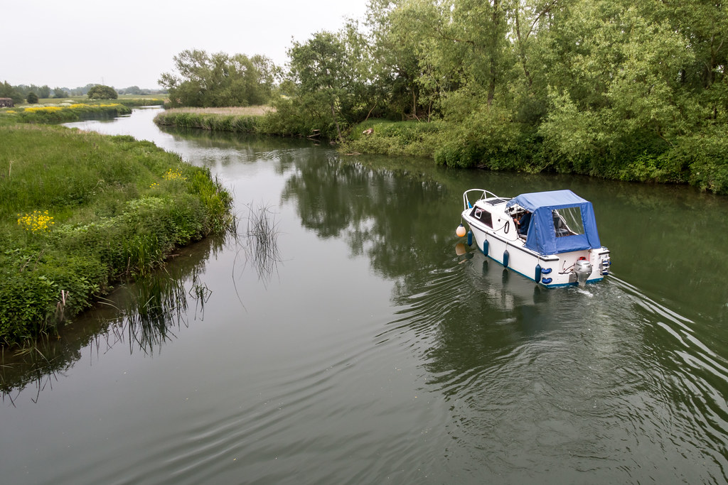
The rest of the path was a rural as ever and I did not see a soul except for a couple at a lock. I passed a few boats and a couple of pedalos as I got close to the Maybush pub, as well as a few walkers. I had truly been on a remote stretch where people don’t really venture. I arrived at the Maybush at 15:30 and had walked just short of 10 miles, which meant I may have cut some corners because my guide book said 10 exactly.
This stretch took a bit of thought because it was starting to get rural. I knew where I had to start/finish but how far to walk so I could get to the other end easily was an issue. Kinston Bagpuize was an obvious choice (including the strange name), but would have involved a long walk and buses to get to Wolvercote. In the end I decided to go for Newbridge by taxi from Oxford centre, it would mean I could do a 11 mile stretch and set myself up well for the subsequent leg.
I parked in a car park at Wolvercote and walked into the village where I got the bus last time. Interestingly the village has quite a few pubs two of them overlooking a village green, it seemed quite quaint. As I approached the bus stop a bloke in a hoodie walking towards me looked at me and seemed to change his mind, and go to the bus stop stand there and spit, then when he realised I was going to the bus stop he walked up the road I had come from, looking back at me. He was acting very suspiciously. I had a 10 minute wait for the bus, but I never saw any more of the dodgy geezer.
Lots of Goslings on the Thames
It did not take long to get to Oxford on the number 6 bus, which dropped me off at the cross roads at the north end of the high street. I dropped I to Starbucks for a coffee and cake, and asked about a taxi rank, which I found after a Kenyan Puccino. The taxi office was a strange place having loads of high value slot machines along side the despatcher. The estimate was about £28 to Newbridge, a lot but I did not have much choice the next bus was in two days!
I got chatting to the Lithuanian driver, who had been working since 1800 the day before, his views on immigration were interesting given that he was one himself, he clearly considered himself European and not an immigrant it was the people from outside Europe who need to be controlled. It just proves that the whole situation is almost intractable.
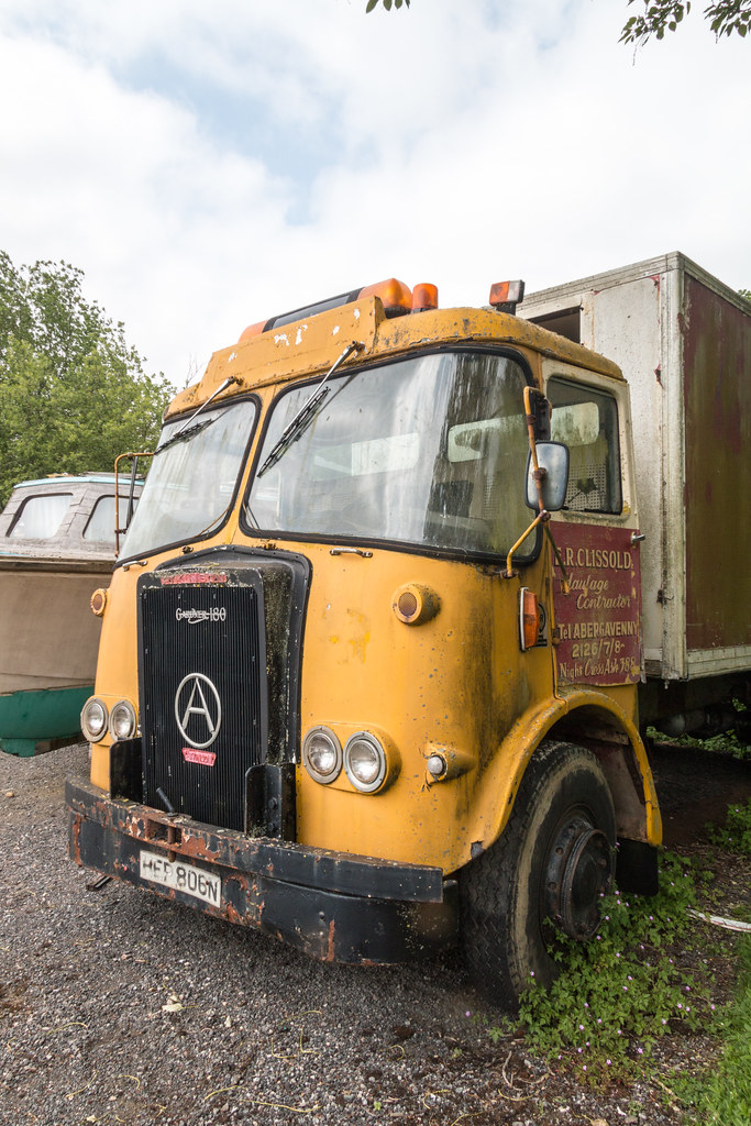
Vintage lorry
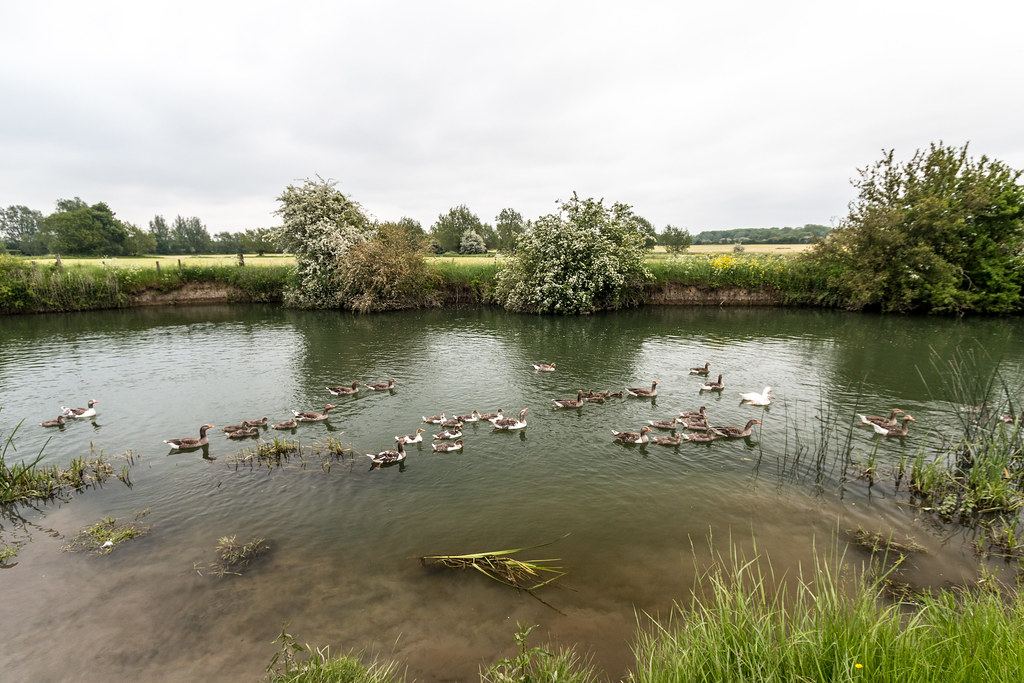
I was dropped off at the bridge at Newbridge where a sign explained that there was another 40 miles to go, however I was doing a stretch the wrong way so my total would only be 40 once I had done the days 12 miles. Not long after I started I came across some geese and goslings there were at least 50 goslings with about 10 adults. The route was very rural and I kept on catching up with a family in a barge at locks and moorings, until I got to the Ferryman pub opposite Bablock Hythe, where I stopped for a coffee.
The path forces you inland for a couple of miles and runs parallel to the river about half a km inland. There were lots of sheep in the fields and at one field boundary with a lot of bleating going on all the mums were corralled for shearing. At Pinkhill lock I stopped to eat my Belgium beer cheese sandwiches, which I had packed because the path did not really go near many option for food. Two lock keepers were on duty one young lady and and older woman I wondered if the younger one was and apprentice.
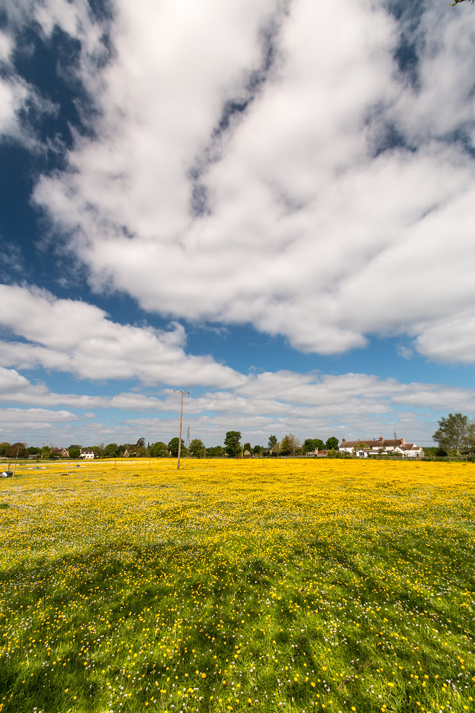
Buttercups
On the last leg I could hear a music beat in the distance and eventually came across a rave on the other bank. The meadows were very covered in buttercups and other wild flowers a sign of ancient fields with no pesticides. After 4 hours I hit the 10 mike mark and only another like and a bit got me back to the car, but not before seeing two blokes swimming in the Thames.
I drove home and had a quick shower before we went to A&C’s for dinner followed by a Proclaimers gig at the Waterside Theatre.
Woke up to overcast skies and light rain, as well as a bad nights sleep, but I was still determined to get another stretch of the Thames under my belt. I would be passing through Oxford hopefully stopping off at a Hindu Festival at Rosehill I had seen posted on Facebook. I was up early and unusually had scrambled eggs on toast for breakfast.
Where to end the walk was a challenge, the Pear Tree Park and ride was about the right distance but a half mile walk from the river. My plan was to park at Wolvercote near the river then walk to the park and ride, but when I got there I was right next to a bus stop so after a short wait I was on my way to the city centre to get the 35 to Lower Radley where I had finished the week before.
House next to Folly Bridge Oxford
Whilst in a queue of traffic near my destination I saw a woman and no less than three young kids on a three person bike (one kid looked too young to pedal) they were on an incline and very low gear but they got to the top in the end. The bus to the centre took in a neighbourhood with some very large three storey houses, I wonder who lives there perhaps the Oxford professors?
A short walk from one end of the high street to the other was needed to get the bus out of town, then a short wait for the 35. The first bus was £2.10 and the one to Radley station was £2.60, what with the free parking it would be a relatively cheap transport day.
The path is a bit over grown from the rowing club and I noticed a few Fresh water clam shells on the path. I’m not sure what would be able to dive for them then eat them, and also leave them on the path. I heard a Cuckoo which sounded quite close, and after scanning the tops of the trees I managed to get a glimpse, I always think it is better to see a bird than just hear it to claim the tick on the year list.
Buttercup field showing ridge and furrow
At Iffley lock I headed away from the river and up hill through a very well to do area called Rosehill where the Festival was being held. It turned out to be not what I was expecting, it was a small affair all indoors, I was expecting a big setup. I did not stay long as the food was not ready and I was expecting rain early afternoon and needed to get a move on.
The towpath became very good as I approached Oxford, and I passed a lot of college boat houses. Many of the boats rowing past were being shouted at by their coxes, one especially wax causing everyone one on the river bank to look round to see this small woman in the back shout at the top of her voice. I passed an interesting building which I later regretted not checking out. it was the Isis Farmhouse at Iffley it is a pub but s inaccessible by road, there were blackboards advertising food and it looked run down in a good way. I skipped it because it was too early for lunch. I eventually got to the Head of the River pub in Oxford, I looked around for a good establishment but there was nothing else near by I ended up spending £15 on a Prawn and Crab Linguini.
Weir at Wolverton
On the way out of Oxford I came across a pub called The Punter, a bit if a player in words, do they mean a customer or a person in a boat, or both. The river was tree lined and a boat with a French name was moored up, at a glance you could have been in France. Soon the I was in a rural area with meadows on each side, the buttercups showed evidence if ridge and furrows farming.
At Godstow lock there us a ruin of a nunnery and I found out that the meadows had not had chemical fertiliser on them for 4000 years and many rare wild flowers grow. Four walls but no roof was left if the nunnery. A short walk in land got me back to the car, it turns out I had parked near the wrong tributary. The total mileage was 11 miles a good distance. The next leg was going to be a challenge, not many towns, villages or roads about.
I missed a couple of weekends on the Thames Path as I was on holiday until n North Norfolk for a week. The weather man promised sed me fine but cool weather which turned out to be perfect for me, blue skies and fluffy clouds and a perfect temperature for walking. I did not get up as early as I might have planned. I drove to Lower Radley CIA the Oxford ring road, where I parked as near to the river as I could get, then I had a half mile walk to the Radley station where I could get a bus to Abingdon. The bus arrived about a minute after I arrived, then as we pulled into Abingdon the T2 pulled into same bus stop perfect timing. I got off the bus in Clifton Hampden a smidge after 11.
Wier at Abingdon
The path is very rural and unpaved most if the way to Abingdon. I could have stopped at the village of Culham, but wanted to get two thirds of the way before I stopped for lunch, which would be at Abingdon. Just before I got there I stopped and put a pair of socks over my 1000 mile socks as I was still having issues with blisters, I’m not sure if I need to have my need two layers or one and tight laces or loose, but the issue is a around the ball of my foot.
Boat house on the Thames
It was only then a short walk to the Nags Head on the river by the bridge at Abingdon. I had a half of beer and a great wood fired pizza which went down a treat. The pub also sold steaks delivered to the table on a hot paving stone. I took the opportunity to try a time lapse sequence using the Magic Lantern software I had installed on my Canon 70d. It allows you to more finely control aspects of the cameras features. Also using the SLR means I can use manual exposure which you can’t do with the GoPro.
The final stretch was rural again, which I expect most of the remaining 60 miles will be. I turned in land at the rowing club at Lower Radley and was soon reunited with the car. With hindsight I could have done a bit further as the final mileage was just short 10 miles. The next stretch will take me to past Oxford, then I think it will become more of a challenge to get appropriate public transport.
I had another free day but was not up too early, I looked at the map and considered Abingdon but it would mean a 13 mile hike, so I settled on Clifton Hampden it would make for a circular walk next with Abingdon as the mod point and a land crossing between the loop of the Thames.
I parked up at the Barley Mow car park just over the river in Clifton Hampden. They clearly get flooded as the pavement was raised in stretches. The plan was to walk to the intriguingly named Golden Balls roundabout, and get to the bus to Benson. The route would mean a 3 mike walk in land. The walk was pleasant starting out at the picturesque chocolate box village of Clifton Hampden, then round the back of the Culham science establishment, and through a bluebell wood in bloom. The sunny weather made for a pleasant walk although there was a chill wind. The timing would be tight for the bus and they pass once an hour. When I got to the roundabout I saw the bus pass it was running late BT four minites but I still missed it.
Clifton Hampden
There is a Notcutts garden centre on the roundabout so I went in there to get some coffee and cake and while away 40 minutes before heading out to the bus stop again. At the bus stop I saw a convoy of about 50 large customised motor bikes drive by. The bus did come just a few minutes late to my relief, the fare to Benson Marina was £2.20. The bus stop is in a sort of side road but cars had parked in the site road in such a way that the bus had to reverse back into the main road traffic to leave the bus stop.
View near Days Lock on the Thames
From the marina it is country side al the way to Shillington bridge where you have to leave the river then down an alleyway to the main road where for about half a mile you have to use the pavement before you can get back onto the riverside. My next stop would be Day’s lock near Dorchester, where I chanced upon a guy just about to take his boat through the lock. I took the opportunity to take a time lapse sequence, whilst chatting to the boat owner. He was on his way to Rugby to some low cost marina he had found. He did gardening jobs to earn a living and seem be a happy with his lot puttering about the country on the rivers and canals. I closed the lock for him to save him having to moor up and return.
After the previous days efforts I was keen to get back to the car, which did not take too long. The weather was just about holding out and it was still cold. This weekend I managed to get another 20 miles done and had 70 miles left to go so I was past the 100 mile point. The next walk would be a circular one taking in Abingdon which is on a big bend in he river.